Water plays a key role in developing and shaping the physical landscape. The effects of surface erosion, water emerging from sub surface sources (i.e springs and seeps) and the development and movement of steams and river channels can create a rich and complex array of geomorphic features.
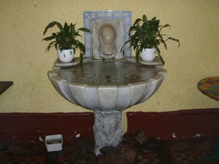
St Ann’s Well, Malvern Hills
The area contained within the Geopark boundary exhibits a diverse range of these hydrological features and examples of water –related issues. Locations within it therefore highlight the importance of water in the landscape, both in terns of physical features, and from the perspective of the interaction between humans and their environment.
To many, the Malvern Hills are synonymous with the presence of water in the forms of springs (or wells, spouts and fountains) with nearly 100 sources located in the area. The Precambrian ridge of the Malverns Complex rock assemblage is characterised by low porosity and high permeability. Springs emerge from fissures in the Malverns Complex, or along the margins of the outcrop where the water reaches the surface as a consequence of the contact with the relatively impermeable younger rocks.
The River Severn and River Teme meet just down stream from the city of Worcester, and together they dominate the hydrology of the area in terms of channel size and flow. In terms of their hydrology and fluvial geomorphology, they are interest because:
- Within the Geopark they are good examples of lowland rivers with broad floodplains. They exhibit some excellent examples of floodplain features associated with long term channel adjustment (e.g suites of river terraces, river cliffs and palaeochannels)
- The Lower Teme has a deep channel cut in a wide alluvial plain. Channel plan-form is one dominated by free menders across the floodplain. Since the Teme is a ‘flashy’ river, which responds rapidly to rain fall inputs to the basin, large and rapid changes in stage, velocity and discharge occur. Thus form-process relationships at the channel margins are readily observable and often spectacular in nature. Channel change can be rapid. Cut-offs and near cut-off are numerous along the river’s course and floodplain features such as backchannels and old oxbows can be seen clearly.
- The Leigh Brook rises on the western side of the Malvern Hills and drains in a northerly then westerly direction to join the River Teme at Bransford. In the lower reaches the brook flows through the Knapp and Papermill Reserve where the brook exhibits many geomorphic features associated with natural steam channels which include:
- Variable bed morphology and in-channel geomorphic hydraulic features (e.g pronounced pool-riffle sequences, flood chutes, rapids, runs, glides, and rippled, smooth and ponded surface flow types)
- Sediment depositional forms (e.g lateral bars, point bars, mid-channel bars and mature islands)
- Erosional features (e.g exposed bedrock, scour pools, undercut banks)
- Evidence of channel change (e.g Bank erosion, marginal backwaters, cut-off channels)
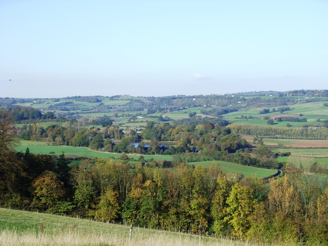
River Teme flowing through the Shelsleys, Worcestershire
