During the Silurain period, the Geopark was about 30 degrees south of the equator.
For much of the Silurian period a warm shallow sea covered the Geopark. Sediments deposited into the sea later gave rise to the rocks of the Abberley Hills. These seas gradually got shallower as two tectonic plates of the earths crust moved together. Their collision pushed up mountains in what is now Wales. Sediments eroded from the mountains were laid down on a semi-arid land surface by steams which were constantly changing coursed on the lowlands.

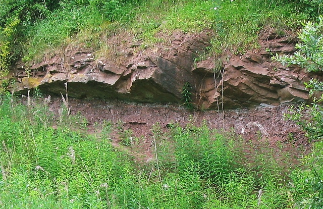
Sandstone overlying mudstone at Linton Tile works
At first the sediments were fine, producing mudstones with some sandstones (the Raglan Mudstone Formation, Silurian in age). Later courser sediments were deposited on top of the mudstones (St Maughans Formation, Devonian in age). These were eroded from the mountains, which became closer to this area as the mountain building continued. The resulting sandstones are moiré resistant to erosion and now form the area of higher land north of Bishop’s Frome. The softer mudstones are more easily worn away and form the lowland of the Frome valley south of Bishop’s Frome.


