The Bridgnorth area is underlain by Permian Bridgnorth Sandstone. These rocks represent fossilised sand dunes and were part of a vast desert that existed around 299 million years ago.
During Permian times the Geopark sat landlocked 20 degrees north of the equator on a single continent known as Pangea. This had formed from a drifting together of all the previous continental plates of the earth’s crust. The wind was blowing sand dunes across a vast Sahara-like desert whilst occasional flash floods deposited alluvial fans.
Close inspection of a typical Bridgnorth Sandstone shows the grains of sand within are well rounded and polished by abrasion as they bounced against each other across the desert surface. The sand is dyed red by iron oxide which weakly cements the grains of quartz together.
Permian Bridgnorth Sandstone display the feature known as dune-bedding in which one set of dunes has been partly eroded and then covered by a new set. This gives rise to a distinctive criss-cross pattern of bedding in the rock. By looking at the shape of these fossilised dunes one can determine the predominant wind direction 300 million years ago when the dunes were formed. Analysis indicates south-east winds which correlates with sub-tropical trade winds found at 20 degrees north of the equator today.
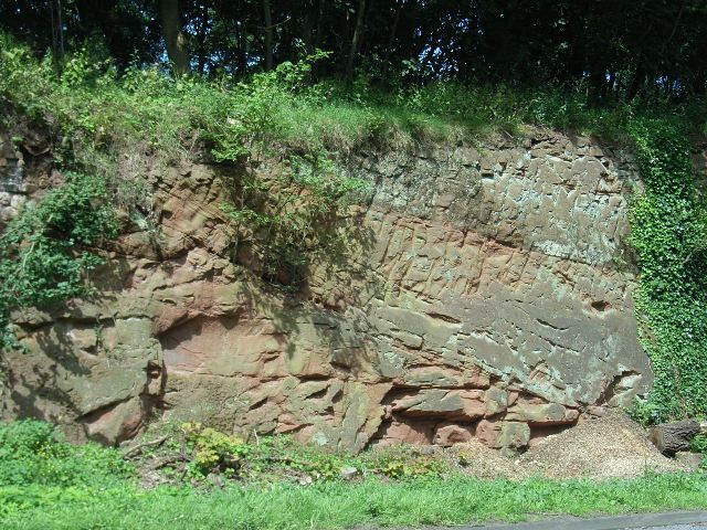
Roadside cutting in Quatford displaying dune bedding in Bridgnorth Sandstone
