Generally this area is underlain by the Old Red Sandstone Raglan Mudstone Formation (Silurian/Devonian), which in this area is traversed by the River Teme. To the west of the Teme, above the Raglan Mudstone Formation and forming the Bromyard Plateau is a wooded escarpment of Bishops Frome Limestone forming the top member of the Raglan Mudstone Formation base and overlain by the St Maughans Formation of Devonian age. To the east is the Silurian ridge of the Abberley Hills, incorporating deposits of the Permian Haffield Breccia on the Worcester side of the hills and also at the southern bank of the Teme as it cuts through the Silurian ridge. To the north and northeast are the Highley Beds of the Carboniferous Coal Measures.
The Teme Valley forms a distinctive drop in the topography as on the eastern side of the Teme, on the Raglan Mudstones Formation, the land is of a hummocky character. This rises up to the ridge of Silurian hills which is over 150 m higher than the river in places. On the west an escarpment some 100 m high ascends to the Bromyard Plateau of the St Maughans Group.
")
View across the Teme Valley from the Abberley Hills
SILURIAN
Pridoli – Lower Old Red Sandstone – Raglan Mudstone Formation
Raglan Mudstone Formation has at its base the Ludlow Bone Bed which appears to rest conformably on the on the Upper Ludlow Shales at the top of the Silurian sequence. The bone beds are coarse micaceous sandstones containing the fish debris that gave the beds their name. Above this are grey shales and beige sandstones which make up the Temeside Beds. There is then a change from grey beds to red marls and micaceous sandstones followed by a band of pebbly coarse sandstones which may be correlated with the Holdgate Sandstone. This coarse layer can be found north of Abberley and may correspond to a similar deposit near Stanford Bridge. Red, green and purple marls dominate and replace the
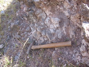
Bishops Frome Limestone
sandstones further up the sequence, towards the base of the Bishops Frome Limestone. In the Teme valley below Stanford Bridge and on both sides of the river these rocks consist of red and green marls with distinctive belts of sandstone. The Raglan Mudstones represent fluvial sedimentation in a hot, low rainfall climate.
The Bishops Frome Limestone (previously Psammosteus Limestone) forms the top part of the Raglan Mudstone Formation. It is best exposed at the western side of the Teme Valley and forms an almost continuous bed along the valley escarpment. The rock is pale greenish limestone which is both massive in some areas and interbedded with marl in others.
Most limestones are formed under the sea from material such as shell fragments. However Bishop’s Frome Limestone is a fossil soil, a chemical, not a marine limestone. It marks a period when deposition of sediment ceased. In the warm, arid conditions on the large land mass, lime-rich ground water was drawn to the surface and evaporated leaving behind concentrations or nodules of lime, calcium carbonate, CaCO3 in the soil.
DEVONIAN
Lower Old Red Sandstone – St Maughans Formation
Above the Bishops Frome Limestone lies the St Maughans Formation. Due to the continental deposition of these rocks, the Silurian – Devonian boundary (as defined by marine fossils) is difficult to place. Generally the Raglan Mudstone is said to be Silurian for the greater part and the St Maughans Formation is Devonian. The St Maughans Formation has mudstones as its dominant sediment type. Sandstones are more abundant in this formation however than the Raglan Mudstone Formation. The marls are a dull red colour and are more compact than the sediments of the Raglan Mudstone Formation. Their grading in to fine, marly sandstones is often indiscernible. In places are hard bands/nodules of red and grey calcareous marlstone, forming an intermediated between the common marls and the limestone. The sandstone colour in this formation has been noted to be anything from red to brown to purple and grey. They are calcareous in nature and fine grained. Sedimentary structures include widespread current bedding which hinders determination of the dip of a given section. The sandstone bands themselves are said to be lenticular based on an inability to match the sandstone bands across stream sections. Immediately above the Bishops Frome Limestone the sandstone is massive, as is another section roughly 90 to 100 m above the Formation’s base. This second massive sandstone is often associated with calcareous intraformational conglomerates (conglomeratic cornstones). The conglomerates do not generally exceed 2 m in thickness and are constantly lenticular, passing laterally into sandstones or marls.
CARBONIFEROUS
Dolerite Dyke
A Dolerite dyke intrudes in to the Raglan Mudstone Formation at Brockhill in the Teme Valley. It is visible on the east bank of the river in a quarry and again on the opposite side but in smaller exposures. The dyke runs in a westerly direction for approximately 1200 metres and has affected the course of the Teme, which runs along it for some way before breaching the hard rock barrier to produce a noticeable meander. At its maximum the dyke is around 7.5 m thick at its centre. Its mineralogy is of an alkali gabbro (teschenite) with pyroxene, serpentized olivine, intermediate plagioclase and interstitial calcite. Along its margins it consists of a 2.5 to 5 cm band of quartz dolerite with pyroxene, lathy feldspar and quartz. There is no contact between these two igneous types suggesting that the quartz-dolerite has resulted from acidification of alkali gabbro magma prior to emplacement. The country rock is altered to a distance of around 9 m on each side of the intrusion converting the marls to a purple rock with light spots of calcite, analite, chlorite and garnet. Tridymite needles have also developed around the quartz grains in the sandstone indicating a temperature range of 870 to 1470˚C. The cornstone has become a quartz-calcite-garnet-hornfels. The age of the dyke is likely to be Carboniferous.
")
Haffield Breccia with sandstone lense
PERMIAN
Haffield Breccia
The Haffield (or Clent) Breccia is Permian in age and is composed of angular fragments and blocks of volcanic rocks in a sand/marl matrix. The rock is haematite stained and so is a dull red in colour. The deposits at Woodbury and Abberley have been described to contain numerous greenstone, felstone, ashy conglomerate, greenstone-amygdaloid, feldspathic ash and porphyry, purple grit, red conglomerate, micaceous marl, green banded slate, ribboned slate and altered black and green slate. The origin of these rocks is said to be locally derived through erosion and transportation by rivers from rocks now buried beneath the Trias that stood proud as highlands during the Late Carboniferous. The deposit at Osebury Rock near Lulsley has been correlated with both the Clent and Haffield Breccias in the past. Generally, the rock is now thought to be of Permian age and is described as Haffield Breccia. Further proof of the age of the unit is needed as an alternative idea places the age at late Carboniferous. This is based on its location west of the East Malvern fault, giving rise to the possibility that it predates the rifting and formation of the Worcester Graben.
Bridgnorth Sandstone
At Osebury Rock the Haffield Breccia can be seen to pass conformably up in to the Bridgnorth Sandstone Formation. This formation represents aeolian windblown sands and is regarded as being of Lower Permian age. The sandstone is generally uniform in thickness and consists of well sorted, fairly well rounded coarse-grained quartz with haematite coatings. Large scale cross bedding can be seen in beds 15-20 m thick. Foresets, up to 4 m thick, consistently dip southwards to indicate depositing winds that originated from the north. The sandstone has little cement and is very friable.
QUATERNARY TO RECENT

Detail of Tufa – Southstone Rock in the Teme Valley
Tufa
Calcareous tufa and travertine is found on the escarpment on the west side of the Teme. The tufa is found in valleys that cut the escarpment, beneath springs in the vicinity of the band of Bishops Frome Limestone which is the likely source for the calcium carbonate. Deposition of tufa and travertine continues today but at a much slower rate than previously. Tufa is formed around the moss Palustriellacommutate. In some areas of the deposits, shade-demanding species dominate the assemblage which indicates the presence of forest cover. In contrast the presence of Palustriella indicates broken canopy. The largest deposit and a prior designated SSSI site is Southstone Rock. The photograph below shows part of Southstone Rock, where several large blocks have become detached from the edge of the cliff and have moved downslope.
