Les Morris was a geographer and geologist who spent his working life as an educator. A wonderful man and founding member of the
Geopark, Les had time for anyone interested in the formation and evolution of our planet and the landscapes upon it.
Les had a vision to bring this story to everyone by unlocking the vast store of our natural heritage tucked away in stone built walls.
In his memory a has been created which you can download and follow. It highlights different rocks which can be found in walls across the Geopark covering millions of years.
Download here Les Morris Trail final draft – v1
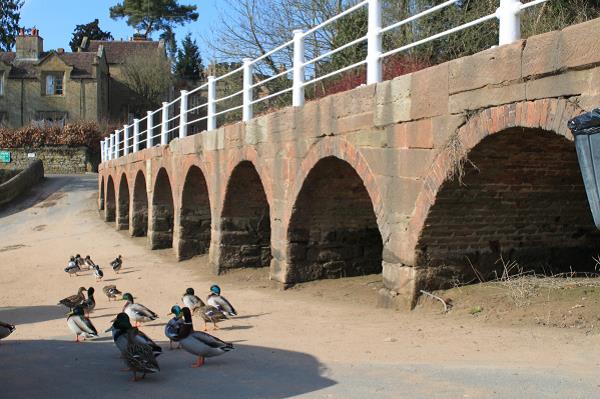
Quayside, Arley, Worcestershire
Across the Geopark there are many different rocks varying in age from 10,000 years old to nearly 700 million years old. Many rocks have been used as building stones in the construction of important historical buildings and also in the building of simple local walls in houses, gardens and barns. They are an easy and accessible way to discover the wonders of rocks and the history of planet Earth.
This trail takes you across an area of 650 square miles from Bridgnorth to Gloucester, and Worcester to Hereford, and all places in between. Information about locations, geology and history is given on the following pages with locations generally running from north to south through the Geopark. All locations are accessible to the public and in most cases access is free of charge. Some will require a walk, others are adjacent to carparks, bus and train routes; many are close to visitor centres and cafes.
Can you find them? The Geopark information map inside will help you. Post codes and grid references are also given as a guide. Tick them off as you work through a geological history of 700 million years. At many locations you will be able to pick up a separate geology and building stones trail leaflet which will take you to new and interesting locations. There are also history trails to pick up in many towns.
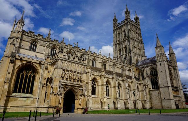
Gloucester Cathedral
