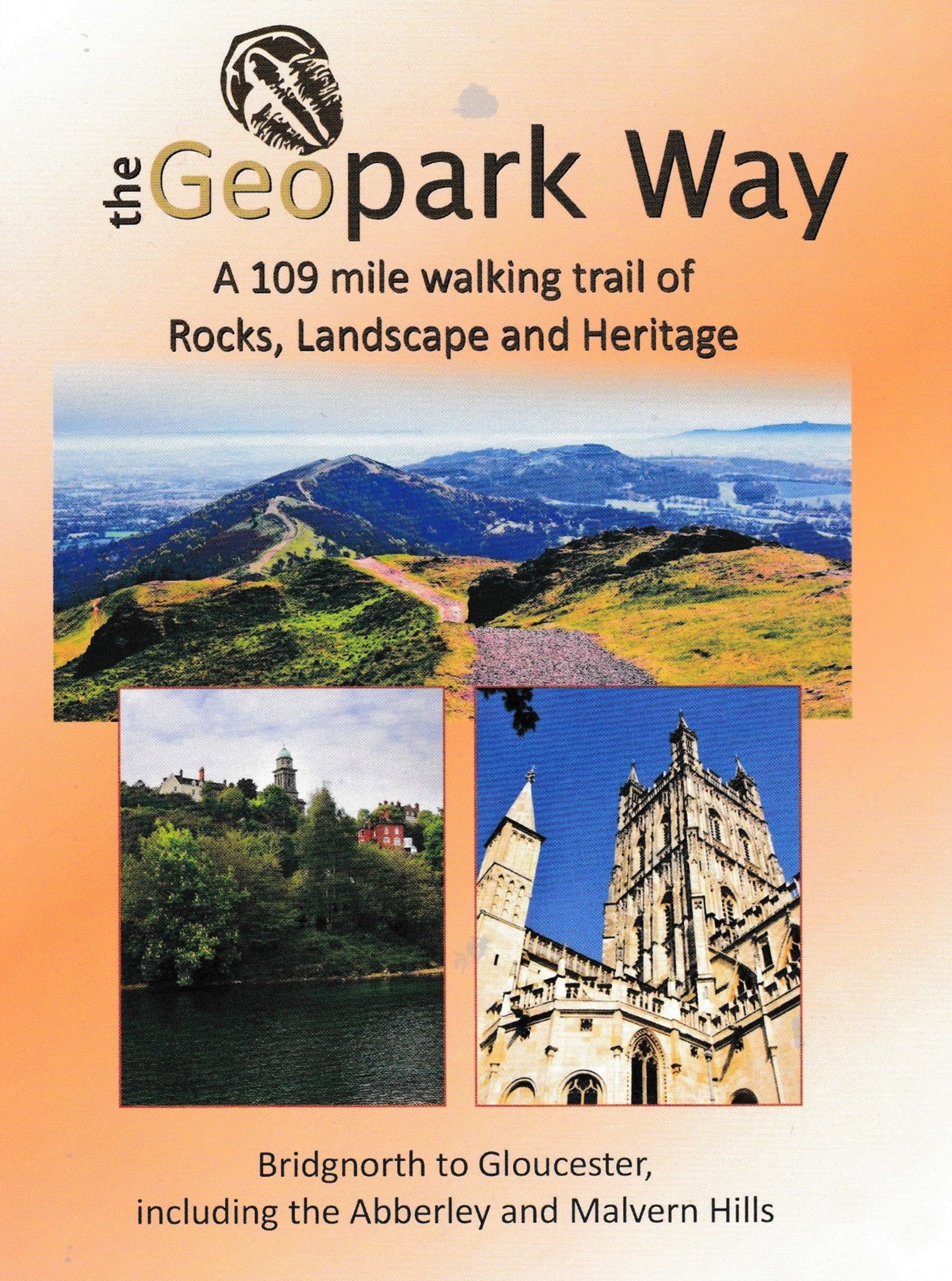
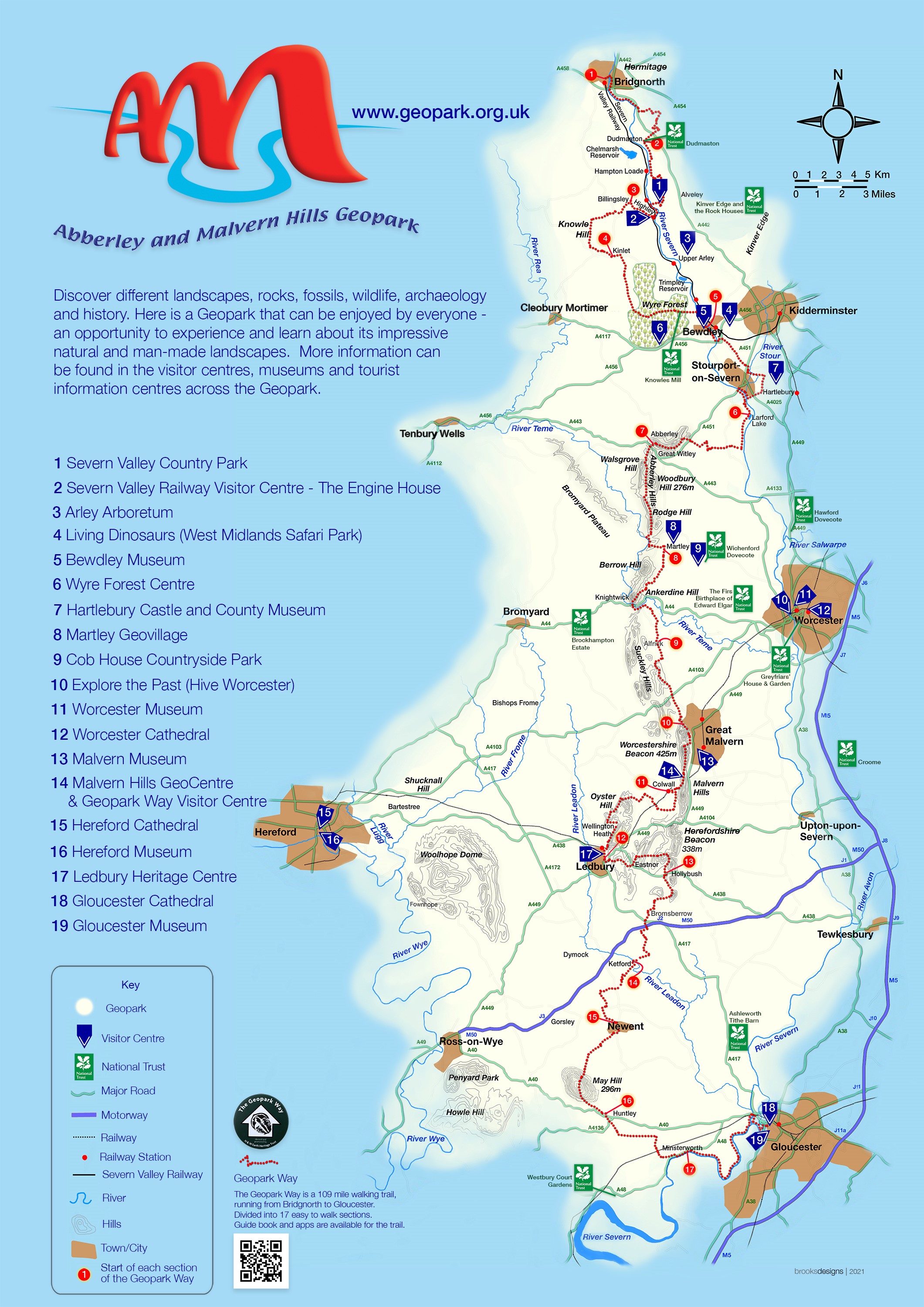
Meandering its way for 109 miles through the Abberley and Malvern Hills Geopark from Bridgnorth to Gloucester, the Geopark Way passes through stunning countryside as it explores 700 million years of geological history. The trail offers varied walking alongside rivers, through forests, along ridges and across valley floors; all with majestic views to match. Passing through an assortment of habitats there is a plethora of wildlife adding to the occasion. Quaint villages and towns dot the route bringing further elements of exploration and enchantment.
Starting in the town of Bridgnorth, Shropshire, the Geopark Way explores the Permian sandstone cliffs that separate Bridgnorth into a High and Low Town, both lying on the banks of, and overlooking the River Severn.
Travelling south from Bridgnorth the trail passes through the Wyre Forest Coalfield. Along with exposures of Carboniferous cyclothem lithologies the trail encounters evidence of the social and industrial impact that the availability of natural resources had on local communities. There is much to be seen highlighting the mining history of the area.
Leaving the coalfield the trail passes over a succession of Permo-Triassic sedimentary rocks and visits the Quaternary wind blown sands that cover the lower terrace of Hartlebury Common. This local nature reserve is celebrated not only for its geology, but as a lowland heath and as a common with a social history spanning at least 2000 years.
Next the trail veers westwards and crosses over the East Malvern Fault where the topography becomes more dramatic as the Silurian limestones and shales of the Abberley Hills come into view. Rock exposures, fossils, bentonites, quarries and abandoned lime kilns collectively tell a compelling story of this series of rocks.
Dropping down from the Abberley Hills the trail reaches the River Teme following its’ course through the dramatic Knighwick Gap, before heading to Alfrick and the spectacular Knapp and Papermill Nature Reserve.
A map of the Geopark…
If you would like a closer view, please select one of the following: NW of the map, NE of the map, SW of the map or the SE of the map
Continuing south and travelling further back in time to the Precambrian the route encounters the Malvern Hills; an area still not geologically fully understood, or at least with theories of chronology still fuelling debate amongst geologists. The Geopark Way visits several sites on the hills to capture the essence of their geological history, peppering the science with tales of folklore and the Victorian Water Cure phenomenon that placed Malvern on the map – what better way to explain hydrogeology!
Leaving the Malvern Hills, the trail pasees the Malvern Hills GeoCentre and then explores the Silurian hills and valleys of the south west quarter of the Malvern Hills Area of Outstanding Natural Beauty before sweeping back to the Malvern Hills ridge Line. Here the horizon changes as the Cotswold Hills come into full view. Into Gloucestershire the trail passes over the inlier of May Hill with its distinctive crown of Jubilee (Queen Victoria) trees, before entering into Huntley Quarry Geological Reserve to explore the fault and fold structures clearly seen on the quarry face.
The final leg of the trail leads you over the relatively flat plains of late Triassic and early Jurassic sediments, visiting sites to unveil the River Severn’s formational history, and perhaps view the Severn Bore, before arriving at its final destination of Gloucester Cathedral. This wonderful building constructed from oolitic limestone marks a fitting end to a traverse across 700 million years of Earth history.
For more information about the guide, click here.”