An exhibition this summer at Bewdley Museum from 22nd July to 24th September
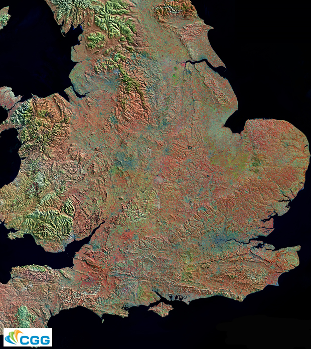
Space satellites now provide exquisite photographic detail of the Earth’s surface. This exhibition shows the local landscape of hills, rivers and rocks as never seen before. Above is a satellite image of the southern part of Britain using a technique known as ‘false colour’ to enhance the exposed rocks and highlight landscape features. Similar but more local photographs will feature in the exhibition. Satellite images and explanations are being provided by the Geological Remote Sensing Group and associated field scale photos and interpretations are being supplied by Geologists in the Geopark.
