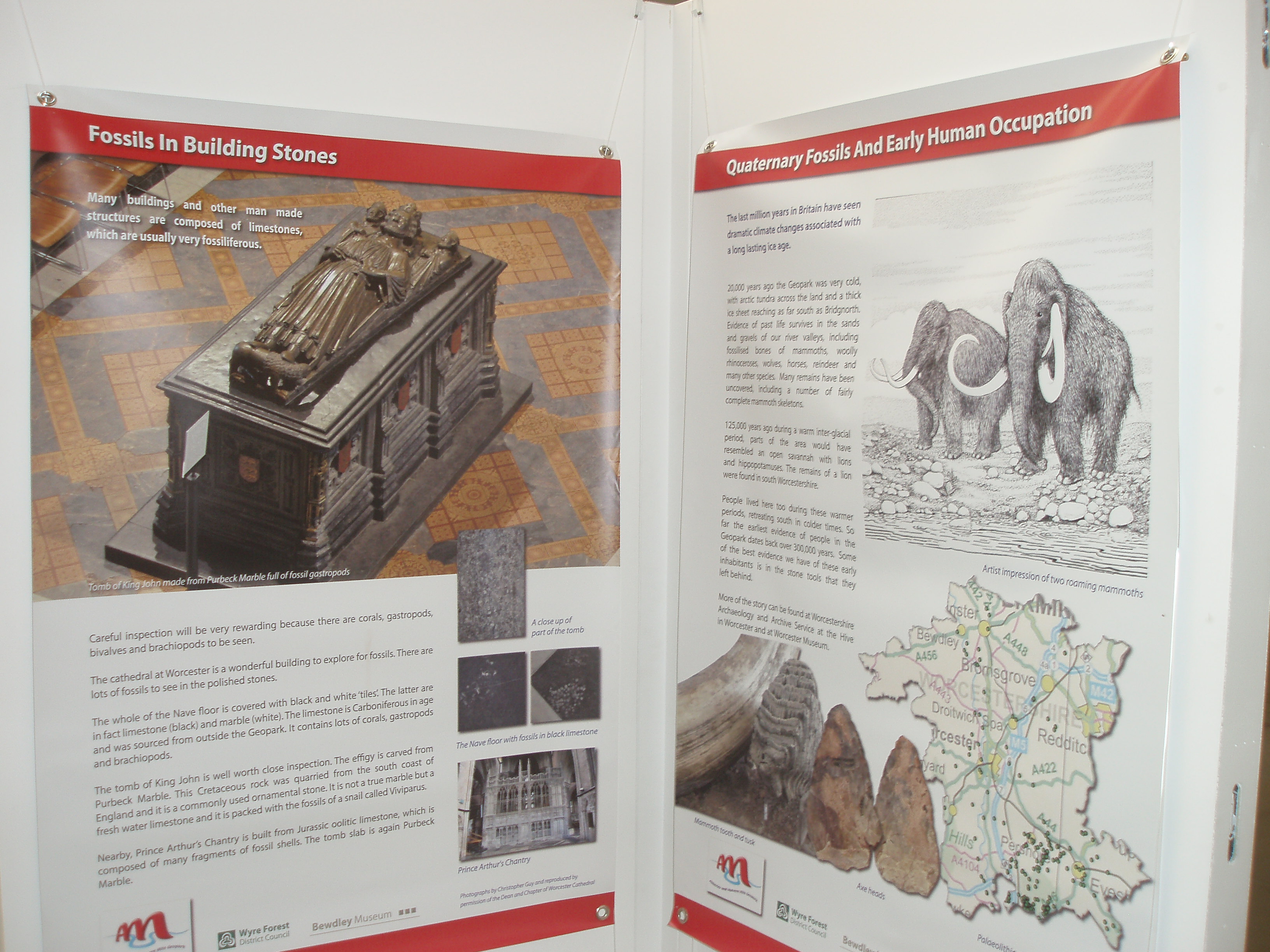
An exhibition this summer at Bewdley Museum from 22nd July to 24th September
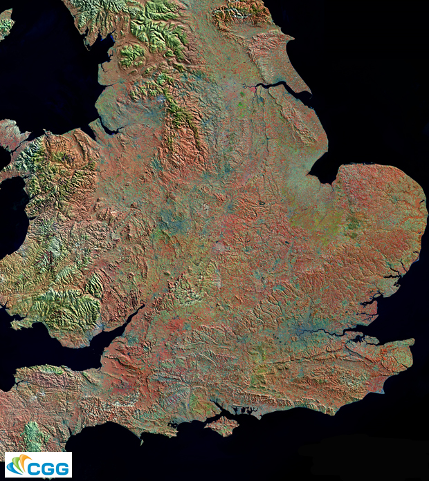
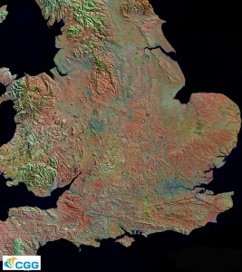
Space satellites now provide exquisite photographic detail of the Earth’s surface. This exhibition shows the local landscape of hills, rivers and rocks as never seen before. Above is a satellite image of the southern part of Britain using a technique known as ‘false colour’ to enhance the exposed rocks and highlight landscape features. Similar but more local photographs will feature in the exhibition. Satellite images and explanations are being provided by the Geological Remote Sensing Group and associated field scale photos and interpretations are being supplied by Geologists in the Geopark.
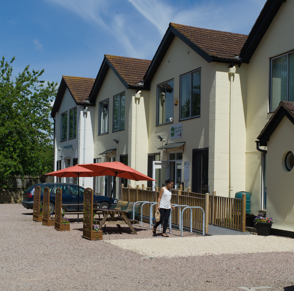
The Malvern Hills GeoCentre is the official visitor information centre for the Geopark Way. It is situated on the western slopes of the Hills, providing information about the Abberley and Malvern Hills Geopark, the Malvern Hills Area of Outstanding Natural Beauty, and the Malvern Hills & Commons. Wall maps in the Centre show the Geopark and its geology, iPads allow visitors to access a wealth of information, and a large video wall shows panoramas and videos of the region. There are also have some small displays of fossils and rocks from the region, and some relevant kids’ activities at a school-desk workstation.
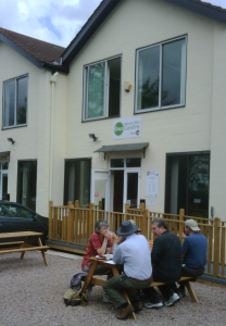 GeoCentre entrance Commanding amazing views over Herefordshire towards Wales, Cafe H2O within the Centre serves a range of light locally sourced / homemade lunches and refreshments. A selection of souvenirs, maps, and postcards are also available for purchase. Facilities include an on-site free car park, disabled access, highchairs & baby-changing facilities, and free wi-fi. For those with limited mobility, it is also possible to hire an all-terrain Tramper mobility scooter so as to visit the Worcestershire Beacon and see some of flora, fauna and geological features along the way.
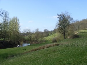
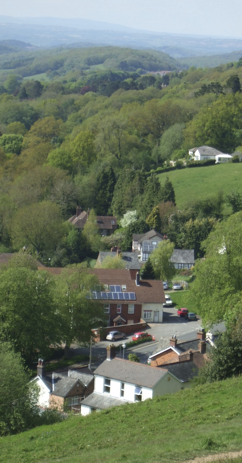 View to GeoCentre and beyond

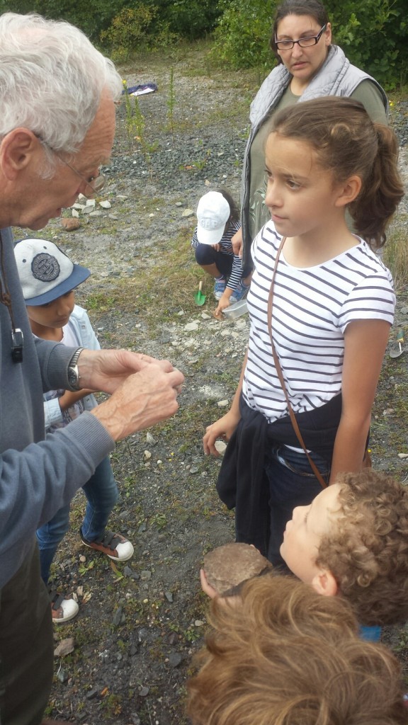
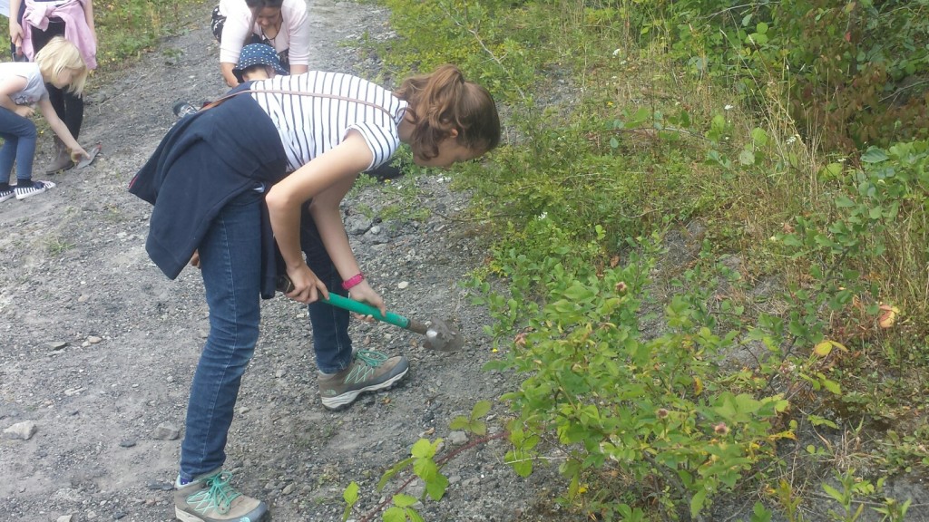
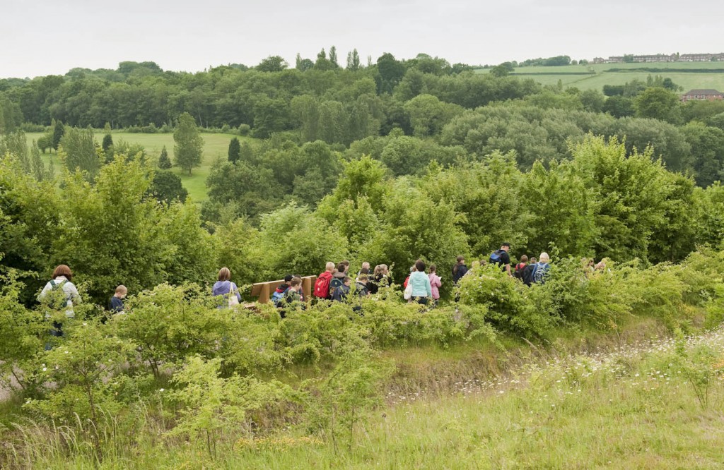
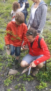
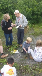
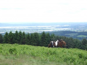
Another two successful rock and fossil hunts round off a great summer of geology at Severn Valley County Park. Both days received a great turnout of young budding geologists, and with the industry experts on hand, it was no wonder the days were full of excitement and learning.
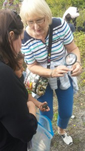
The young fossil hunters identified different rocks such as Sandstone, Limestone, Coal, Dolerite and Quarts. Some were lucky enough to find fossilised plants and shells in their rocks!
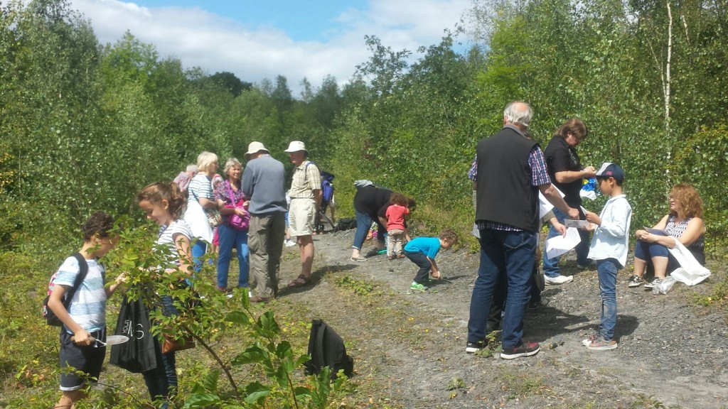
Take a look at the pictures to see what they got up to
As part of their national tour for summer 2016, Rain or Shine Theatre Company is performing a fantastical Shakespearean delight, A Midsummer Night’s Dream, at a local Shropshire beauty spot.

Shropshire Council rangers at Severn Valley Country Park are delighted to see the return of the company to the park on Friday 12th August for their outdoor performance of this magical and hilarious comedy.
In the story the audience is asked to join the lovers, Hermia, Helena, Lysander and Demetrius this summer as Rain or Shine follow them into the intoxicating dream world of fairy queen and king, Titania and Oberon. With well-loved characters such as Bottom and Puck in tow, join us for a rip-roaring, fast-paced jaunt through Shakespeare’s best loved comedy this out-door season. Filled with magic and mischief, inspired by warm nights, young love and the Elizabethan Carnival, this is as show sure to delight.
Rain or Shine is a Gloucester based professional theatre company which specialises in outdoor summer tours of classical theatre to castles, stately homes and gardens throughout the U.K. They have performed classic comedy productions of works by Shakespeare, Sheridan, Goldsmith, Wilde and Vanbrugh to tens of thousands of happy theatregoers since they were formed in 1998.
Tickets are £13 Adult, £11 Concession, £6 Child (suitable for age 6 upwards). Tickets are available by calling 01746781192 and will be available to purchase on the door on the night.
Gates open at 6.30pm with the performance starting at 7.30pm. Visitors are invited to bring a picnic and low backed seating to add to their enjoyment of the performance.
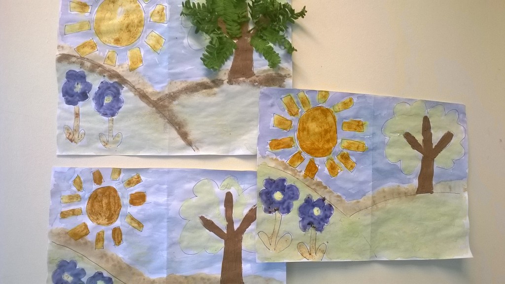
We had great fun on Wednesday with our Nature’s Art Attack session. During the sessions the children collected lots of leaves, grass twigs and other natural items from around the park. We had a great time mashing, squashing and bashing everything we found to make some paint to colouring a lovely landscape.
 Severn Valley Country Park A big thank you to Georgia Jacobs joined us to help the children make cards using cut out leaves, ink stamps and more. The children had a great time!
We have events every Wednesday and Friday of the school holidays. Geologists in the Geopark will be with us on Mon 8th August & Thurs 25th August for a Rock and Fossil Hunt. It’s going to be a fun summer!
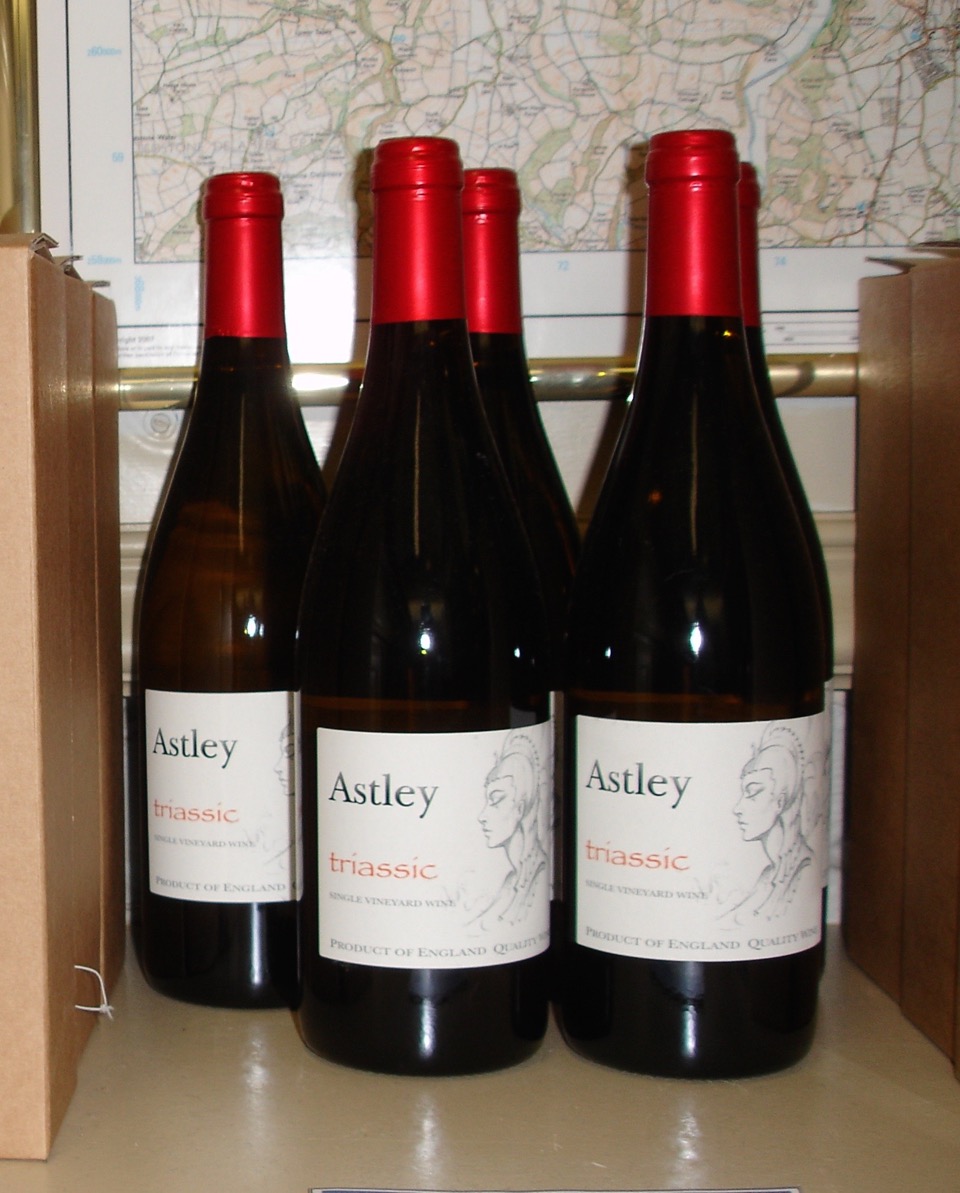
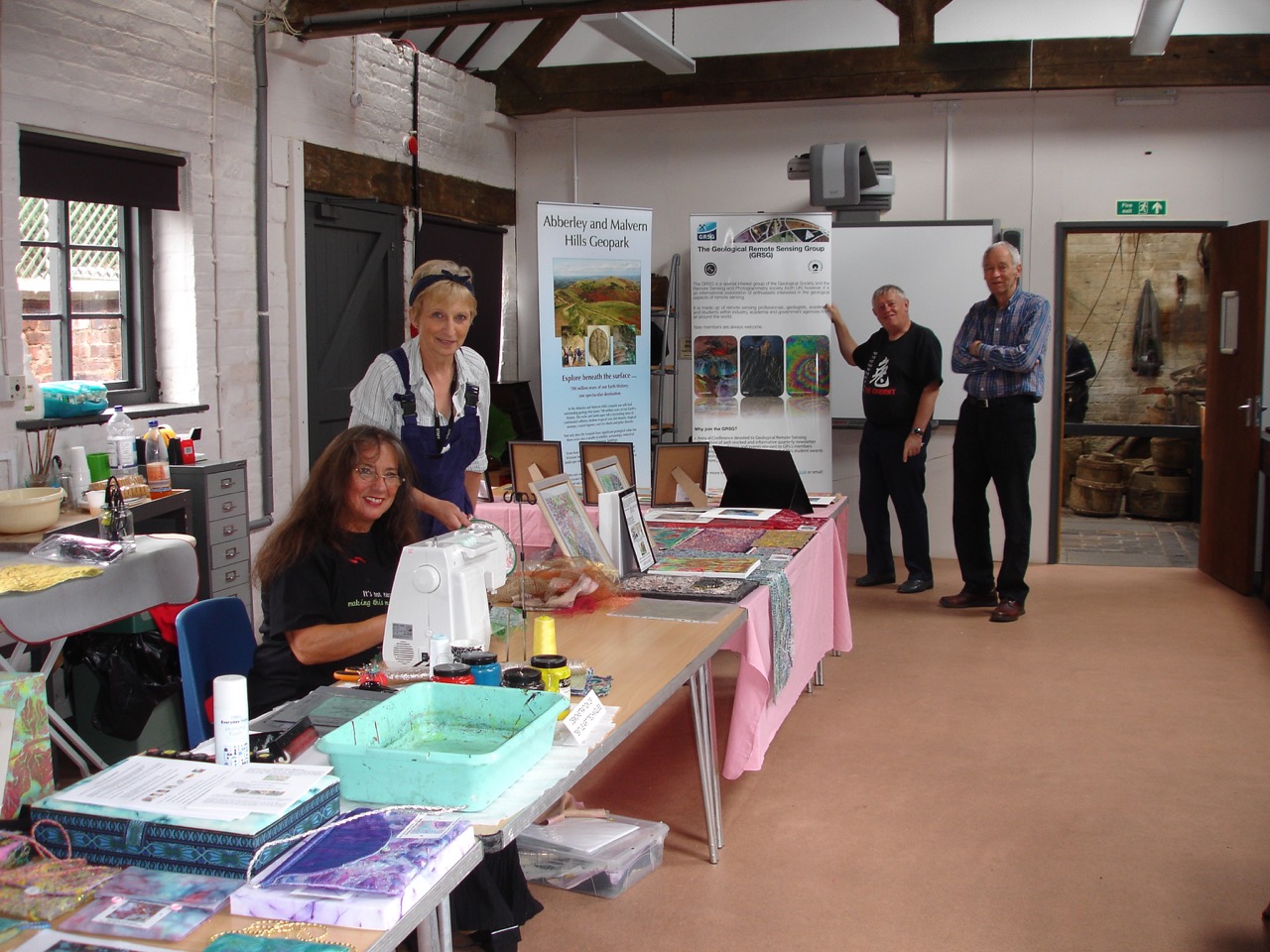
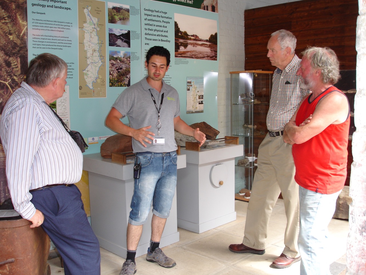
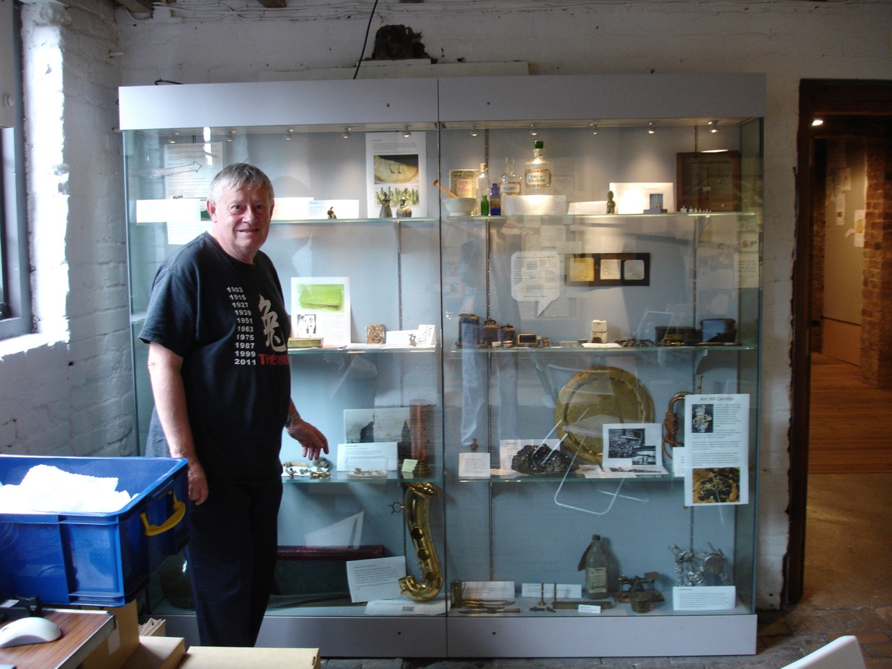
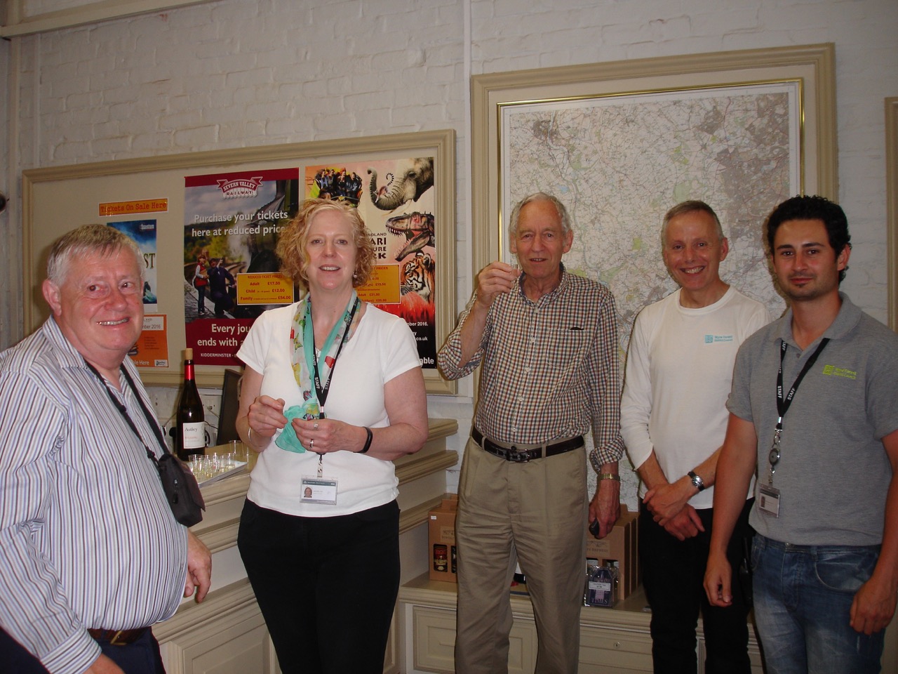
The President of the Geopark Chris Darmon made a visit to GeoFest on 22nd, 23rd and 24th July. During his time with us he launched the revamped GVIP (Geopark Visitor Information Point) at Bewdley Museum, he promoted Triassic wine from Astley Vineyard which is for sale in Bewdley Tourist Information Centre and he opened the geology inspired textile demonstration and visited the ‘One Grain’ exhibition, both at the Museum.
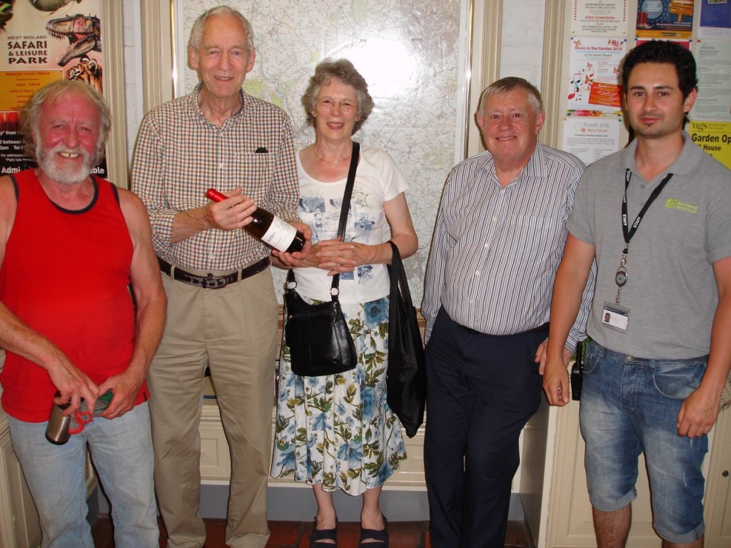 Launch of Triassic wine at Bewdley TIC
 Astley Vineyard’s Triassic white  Textiles, with Georgia Jacobs at the sewing machine 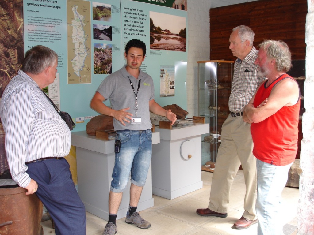 Ross Iannoccaro explains the additions to the Geopark Information Point. There is so much going on in GeoFest with plenty more to come in August. Details are in the calendar on the website. The textiles exhibition ‘Geology at Different Scales’ continues at Bewdley Museum until 11th September.
 Georgia Jacobs with her geology inspired textile demonstration. 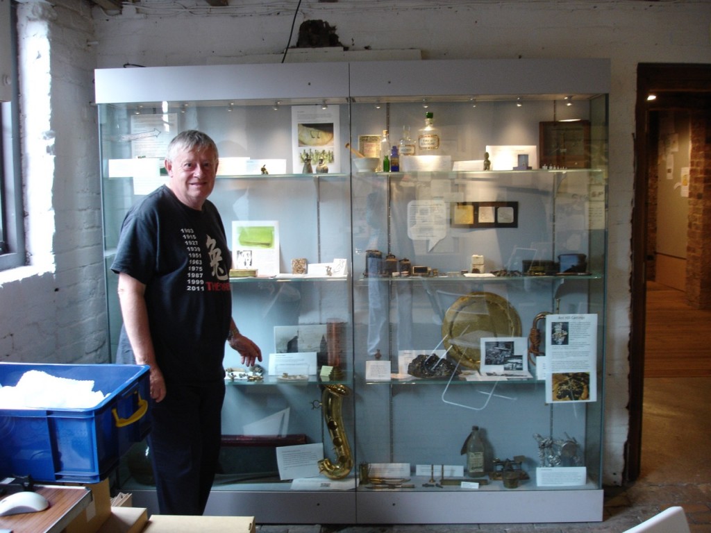 Chris Darmon visits the ‘One Grain’ exhibition in the Brass Foundry  Bewdley TIC staff and Triassic wine tasting session
Keep up to date with all that is happening in GeoFest on our Facebook page www.facebook.com/AbberleyandMalvernHillsGeopark
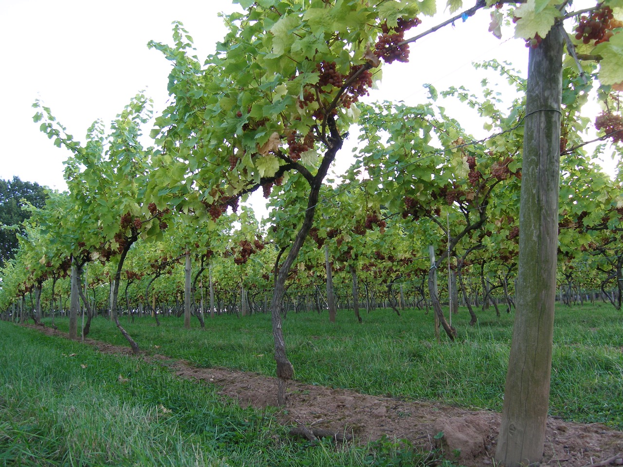
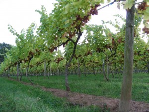
We are working closely with Astley Vineyards to promote a special wine called Triassic. Located on Bromsgrove Sandstone the vineyards portray that wonderful association between geology, landscape and land-use.
Astley Vineyards, one of England’s oldest surviving vineyards, was started by viticultural pioneer Michael Bache in 1971. Although for that time, N.Worcs would have been considered far too northerly for successful wine grape growing, Bache’s dedication to his task paid off as the wines produced won wide recognition and acclaim nationally and internationally.
The vineyards comprise 5 acres established on Triassic red sandstone loams on a slightly NE facing slope within half a mile of the River Severn, 3 miles south of Stourport-on-Severn, in North Worcestershire. Prior to being a vineyard, the field was a traditional English cherry orchard, eventually removed courtesy of the 1947 Agricultural Act’s grubbing up grant. The basic terroir has therefore a history of minimal intervention and apart from tile drainage, remains so. It is inherently low yielding and the current viticultural practice is designed to maintain low yields to maximise wine quality. Adjacent to the vineyards, a small stream has cut an intimate valley into the soft rocks. This feature acts as a drain for both rain and frost thereby serving as a critical positive factor in the vineyard’s success.
The purpose of all wine production should be the creation of a product that contains some unique essence of where it was grown. Astley’s “Triassic” dry white wine, a blend dominated by the Siegerrebe grape, is named after the vineyard soil’s parent material to reflect the influence of local geology on the character of the wine.
The wine can be purchased from the shop at Bewdley Museum where there is also more information about the geology of the Geopark.
Shropshire Council rangers at Severn Valley Country Park are pleased to announce a day of fantastic events on Sunday 26th June.
During the day there will be a guided walk, a guided rock and fossil hunt and a self-led rock and fossil detective trail.
The guided walk (11.15am-1pm) will be around the remains of Alveley colliery. It has been organised by Alveley Historical Society and led by member David Poyner, For over thirty years, what is now Severn Valley Country Park was the site of Alveley Colliery, in its day, one of the most up to date coal mines in the country, employing over a thousand men. Even today, nearly 50 years after it closed, there are still many clues as to the former use of the site. This walk will look at the mining remains on both sides of the Severn and will follow the journey of coal from its emergence from the ground to its dispatch by lorry or on the Severn Valley Railway. In the afternoon, there will be a 2 hour family friendly rock and fossil hunt from 1.30pm-3.30pm. Local experts from ‘Geologists in the Geopark’ will be with us as part of Abberley and Malvern Hills Geofest 2016. Visitors will have the chance to find their own carboniferous fossil. The session starts at the visitor centre with a brief introduction to the fascinating geology of the park and what might be found during the hunt. As visitors dig into an exposed area of coal spoil, the Geologists will help identify what has been uncovered. The rocks and fossils can be found on the surface or just underneath it so visitors are asked to bring a small trowel and a plastic tub with them. An identification sheet will also be provided and it will be possible to take any finds home.
In addition throughout the day visitors will be able to turn detective on our self-led rock and fossil trail. There will be clues to follow around the park and 10 different types of rocks and fossils to identify on our trail detective posters. All rock and fossil detectives will be issued with a certificate after completing the trail. Trail maps are £2 and are available from the visitor centre all day between 11am-4pm
These events are a taster for the upcoming Coal Mining Heritage weekend to be held at the park on 2nd & 3rd July which has been co-ordinated by Alveley Historical Society.
To book please call 01746 781 192. Guided walk Adult £3.50, Child £2. Rock and fossil hunt Child £3.50, Adult free.
How much do you know about the planned canal from Kington-Leominster? As part of GeoFest, the Woolhope Club have a walk on Sun 5th June, it starts 10:30am from Rock Village Hall. Find out more on our GeoFest page http://geopark.org.uk/pub/category/geofest-2/
Merlin Energy Resources Ltd. is a company based in Ledbury with a trading division Merlin Datawise based in Colwall. We are a team of specialist consultant geoscientists and experienced data managers who wholeheartedly support the ethos of the Abberley and Malvern Hills Geopark Forum: “To raise awareness of geology, landscape and associated heritage and to promote tourism, conservation, access and education across this spectrum”.
Merlin is excited to offer both financial support to the Geopark as well as our specialist skill sets and knowledge to assist in making the earth sciences more enjoyable and accessible to more people in our local area.
The GeoFest programme for June, July and August is now available – see GeoFest section for details. Hundreds of days of activities, walks, exhibitions, workshops and other events. Plan your summer now and find out about rocks, fossils, wildlife, heritage, history, archaeology, landscape and much more.
The Geological Remote Sensing Group (GRSG) is a special interest group of the Geological Society of London (GeolSoc) and the Remote Sensing and Photogrammetry Society (RSPSoc). The GRSG is an association of enthusiasts keen on the geological aspects of remote sensing. The current membership includes geologists and remote sensing experts employed within industry, academia and government agencies, as well as graduate students. Although the parent bodies are both based in the UK the GRSG is an international organization with members around the globe. Each year the GRSG holds its own annual conference devoted to geological remote sensing and sponsors a number of other geological events and initiatives which includes those of the Abberley and Malvern Hills Geopark and we are pleased to be involved with this initiative and the events that the Geopark holds in 2016.
www.grsg.org.uk
 A passion for orchids Shropshire Council Rangers at Severn Valley Country Park are happy to welcome back orchid expert, Phil Seaton. Phil will be speaking about his passion for orchids across the world, focusing mainly on Latin America. Worldwide there are over 25,000 species of orchids, making them one of the largest plant families. Many species are threatened with extinction in their natural habitat due to climate change, habitat degradation, over collection for ornamental proposes or use in traditional medicine.
Over the past ten years, Phil has been managing an orchid seed banking project for the Millennium Seed Bank at the Royal Botanic Gardens, Kew. The project has taken him to a number of countries throughout Latin America (Cuba, Mexico, Costa Rica, Brazil, Ecuador and, most recently, Colombia) both promoting collection and storage of orchid seed as a conservation tool, and searching for orchids in their natural habitats from high in the Andes to the Caribbean coasts.
Mr Seaton took early retirement from lecturing in Biology to work in orchid conservation and he regularly uses the labs at King Charles 1st School in Kidderminster, where he works with the students studying and growing both local and tropical orchids. He is also the author of a number of informative books including ‘Growing Orchids from Seed’
Visitor Centre Manager Susie Comaish says, ‘Last year’s talk looked at the conservation of British orchids but Phil’s knowledge of orchids is global. It will be fascinating to hear more about these special plants from around the world.’
The talk ‘A Passion for Orchids: Orchid Travels in Latin America’ will be held at Severn Valley Country Park’s visitor centre on Wednesday January 13th 2016, 7.30pm-9pm. Tickets are £4 Adults, £2 Children £3 Members of the Shropshire Wildlife Trust. Tickets include a hot drink and biscuits. Places are limited so please call 01746 781192 to book.
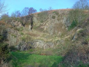
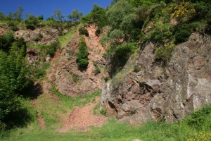
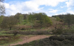
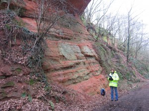
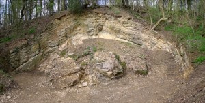
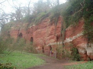
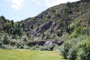
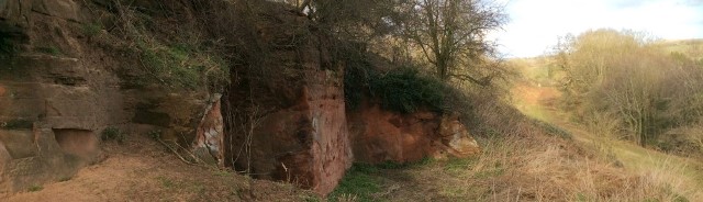
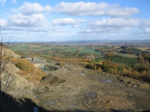 Shavers End Quarry as viewed from Abberley Hill Geological Overview
Abberley Hill rises out of the otherwise gently rolling landscape and is made up of rocks that formed around 420 million years ago, during the Silurian Period. These rocks were uplifted along a line of weakness in the Earth’s crust during a mountain building events that happened between 360 and 250 million years ago.
At locations such as Shavers End Quarry the layers of Silurian-aged limestones and shales you can see that they layers of rock are almost vertical, and even in places have been overturned, all due to the powerful forces exerted on the rocks during the aforementioned mountain building event.
Location
Astley and Dunley & Abberley, worcestershire; Grid Reference: SO 7603 6697
Access
Open, along public rights of way
Geological Age
The Hill – Silurian
Rock Types
Sedimentary – Shale and limestone
Features
Explore the underlying Silurian rocks
Fantastic views to the north and east that reveal the varying geology of the surrounding landscape
Interpretation
Shavers End Quarry interpretation board – exploring the structure and lithologies of Abberley Hill
Abberley Hill interpretation board exploring the surronding landforms and landscapes
Section 6 of the Geopark Way trail
Explore Abberley Hill trail guide
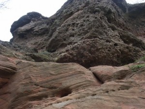
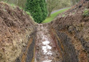
 Astley sunken lane Geological Overview
This sunken lane leads from Astley church down to Dick Brook and Newbridge Coppice. The track cuts down through several layers (beds) of red sandstone – a Triassic-aged rock which formed around 230 million years ago.
Many of the different layers of sandstone display varying sedimentary structures. Beds differ in thickness, some displaying no features, others are finely laminated, other are cross bedded.
With the diversity of sedimentary structures and grain sizes, some of them subtle, this sunken lane is a pleasing location to explore the environment in which the sediments were first deposited to later be formed into rock. What type of environment allows for this rapidly (in geological terms) changes in environment to create the sedimentary structures seen?
Location
Astley, Worcestershire; Grid Reference: SO 7890 6745
Access
Open, along public rights of way
Geological Age
Triassic – Bromsgrove Sandstone Formation
Rock Types
Sedimentary – Sandstone, siltstone, mudstone
Features
Variable grain-size
Sedimentary structures
Interpretation
Section 6 of the Geopark Way trail
 Callow Hill Quarry Geological overview
The quarry lies some 200m from the Wyre Forest Discovery Centre. The quarry consists of Carboniferous conglomerates, sandstones and siltstones together with exhbiting sedimentray features.
This is a Community Conservation Champions site. The ‘Champions’ are a loosely knit group of volunteers who are actively involved in the maintenance and public promotion of 19 geological sites spread across the counties of Herefordshire and Worcestershire. They are engaged in a wide range of activities which vary according to the nature of the site.
Location
The Wyre Forest, Callow Hill, Worcestershire Grid Reference: SO 7478 7408
Access
Restricted access. Please contact the Community Conservation Champions.
 Geological Age Geological Age
Carbonifeorus – Etruria Formation
Rock Types
Sedimentary – Sandstone; conglomerate; palaesols
Features
Variable lithologies
Sedimentary structures
Fossils
Interpretation
Interpretation board on site
An infomation leaflet is available
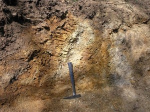
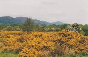 Gorse on Castlemorton Common Geological overview
The free draining common owes it’s presence due to the gravel which underlies it. These are fragments of rock that have been washed down from the Malvern Hills during summer melts in the Ice Age. The ground on the common was frozen, and the waters that flowed down would have deposited the material it carried on the surface.
In the banks of a stream, are Pleistocene Malvern Gravels containing pinkish Malvern granite and darker pebbles of volcanic rock from the hills above set in a finer matrix.
Location
Castlemorton, Worcestershire Grid Reference: SO 791 390
Access
Open access
Geological Age
Triassic
Quaternary
Features
Fluvial processes
Incised channel
Meanders
 Gneissose foliation in Chase End Quarry Geological Overview
The quarry lies within a fault-bounded inlier (an area of older rocks surrounded by younger rocks) composed of the rocks of the Malverns Complex. This inlier forms the southernmost extent of the Malvern Hills and, as such, the quarry is the most southerly exposure of the Malverns Complex. The rocks in the quarry are metamorphic rocks of the Malverns Complex. The rocks were originally diorites; medium to coarse grained intrusive igneous rocks, containing plagioclase, amphibole or biotite, estimated to be around 680 – 670 million years old.
Location
Bromsberrow, Malvern Hills, Gloucestershire; Grid Reference: SO 7580 3505
Access
Open
Geological Age
Precambrian – Malverns Complex
Rock Types
Igneous – Diorites
Metamorphic- gneiss
Features
Gneissose foliation
Pegmatite veins
Interpretation
Interpretation board on site
‘Uncovered’ Chase End Hill trail guide
Section 13 of the Geopark Way
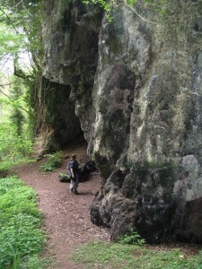
 Clutters Cave, Malvern Hills Geological Overview
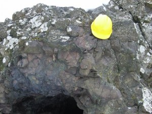
South of British camp on the Malvern Hills just below the west side of the ridge is a man made cave, Clutter’s Cave or Giant’s Cave. This has been excavated into pillow lavas. Almost 600 million years ago a volcano erupted under the sea. It was cooled by the cold sea water and a solid crust formed around globules of lava, which were piled up as more lava erupted. Though they have since been deformed by Earth movements some of the rounded ‘pillow’ shapes can still be seen around the entrance to the cave.
Here there are also beautiful views over the Herefordshire countryside and from the ridge over the valley of the River Severn to the Cotswolds
Location
Eastnor, Malvern Hills, Herefordshire; Grid Reference: SO 7619 3937
Access
Open access
Geological Age
Precambrian – Warren House Volcanics
Rock Types
Igneous – Basalt
 Dingle Quarry Champions Site Geological overview
Dingle Quarry is a small quarry in West Malvern. It is split into three different levels: Lower, Middle and Upper Dingle. Lower Dingle is located to the rear of a bus stop, with much of the exposure obscured by vegetation. Middle and Upper Dingle are located off a path directly above the bus stop. Middle Dingle can be easily accessed, whereas Upper Dingle cannot be accessed safely.
The geology of Dingle Quarry dates to the Precambrian, approximately 680 Million years ago, which means the rocks are some of the oldest exposed in England. The clear quarry face enables amateurs and experts to study the complex nature of the igneous and metamorphic geology on display.
Dingle Quarry is a Community Conservation Champions site. The ‘Champions’ are a loosely knit group of volunteers who are actively involved in the maintenance and public promotion of 19 geological sites spread across the counties of Herefordshire and Worcestershire. They are engaged in a wide range of activities which vary according to the nature of the site.
Location
West Malvern, Malvern Hills, Worcestershire Grid Reference: SO 7650 4567
Access
Open access
Geological Age
Precambrian – Malverns Complex
Rock Types
Igneous – diorite; granite; dolerite
Features
Dykes
Fault breccia
Shear zone
Variable lithologies
Interpretation
Interpretation board
Malvern Community Champions trail and guide
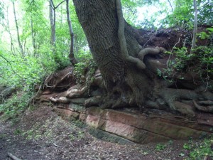
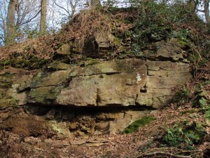
 Dog Hill Wood, Ledbury Geological Overview
TDog Hill Wood and the immediate surrounding area tell a fascinating geological story. Byinterpreting the different rocks seen, including their relationships to each other, the incredible story of how these rocks came into being, along with the events that took place to shape the landscape, all begin to emerge.
The rocks that underlie Dog Hill Wood all formed during the Silurian Period. It was a pioneering British geologist, Sir Roderick Murchison, who first identified this series of rock in the 1830s during his extensive field investigations in South Wales and in Herefordshire.
Location
Ledbury, Herefordshire; Grid Reference: SO 7127 3837
Access
Open along public right of way
Geological Age
Silurian – Wenlock
Silurian – Ludlow
Rock Types
Sedimentary – Limestone; shale
Features
Variable lithologies
Fossils
Local geological history and structural setting
Interpretation
Interpretation board on site
Ledbury – Over coral seas and sandy deserts (a ‘Walks for Health’ leaflet)
Section 11 of the Geopark Way trail
 North and End Hills, Malverns Geological Overview
The main body of the Malvern Hills comprises a north-south trending ridge of igneous and metamorphic rocks. The extremely resistant nature of these rocks contributes towards the elevated nature of the Hills in comparison to the surrounding landscape. Throughout their geological history the Hills have experienced lengthy periods of uplift with localised folding and faulting in response to major Earth movements. Compressive forces associated with the creation of the supercontinent Panagea, some 300 million years ago, contributed to the elevation of the Hills and also led to the development of a series of faults which cut across the ridge. These faults have disrupted the north-south alignment of the Hills, displacing some of the Hills to the west.
Location
North Malvern, Malvern Hills, Worcestershire: SO 7669 4699
Access
Open access
Geological Age
The Hill is Precambrian – Malverns Complex
Features
Fantastic views of the Mesozoic Worcester Basin to the East; Silurian hill and valley topography to the west; the line of the East Malvern Fault towards the Abberley Hills ridgeline to the north
Structural geological history setting for the area, the Geopark and the region
 Gardiners Quarry Champions Site Geological overview
In Gardiners Quarry the story is not so much one of differing rock types, but about what has happened to the main mass of the Malvern Hills rock since it formed all those years ago during Precambrian times. The main body of rock in the quarry is diorite. Rather than being one continuous body of rock however, the quarry face is fractured – sections of the rock have broken apart forming joints, or have broken apart and moved – been displaced, relative to the neighbouring section of rock along geological faults. Along with displacing and fracturing masses of rock, movement along these faults has left other telltale signs in the rocks – slickensides, dykes and mineralisation.
Gardiners Quary is a Community Conservation Champions site. The ‘Champions’ are a loosely knit group of volunteers who are actively involved in the maintenance and public promotion of 19 geological sites spread across the counties of Herefordshire and Worcestershire. They are engaged in a wide range of activities which vary according to the nature of the site.
Location
Colwall, Malvern Hills, Herefordshire; Grid Reference: SO 7662 4207
Access
Open access
Geological Age
Precambrian – Malverns Complex
Rock Types
Igneous – granite, dolerite
Features
Variable lithologies
Shear zone
Faulting
Dykes
Veining
Slickensides
Area structural geology
Interpretation
Interpretation board
Malvern Community Champions trail and guide
‘Explore’ Malvern Hills 1 guide
 Gullet Quarry, Malvern Hills Geological overview
The main face shows a cross-section through most of the Preambrian rock that makes up the core of the Hills. The face itself exhibits many rock types including diorite, granite, gneiss, schist, pegmatite and dolerite. The evidence of the complex history of earth movement which formed the Hills can be seen by multiple joints, fractures, faults and shears, which make identifying changes in rock types difficult. Within these features mineral deposits such as haematite, calcite and epidote can be found.
The nature of the contact between the Malverns Complex and the overlying Silurian rocks has been a matter of debate for many years, although the balance of opinion now favours an unconformable relationship. A fault which cuts the Silurian sequence and extends into the Malverns Complex below is probably of Upper Carboniferous age, associated with the uplift of the hills.
Location
Eastnor, Malvern Hills, Herefordshire; Grid Reference: SO 7616 3813
Access
Open access
Geological Age
Precambrian – Malverns Complex
Silurian – May Hill Sandstone Group
Rock Types
Sedimentary – donglomerate; sandstone; limestone; shale
Igneous – dolerite; granite;
Metamorphic – gneiss; schist
Features
Dykes
Veining
Altered doleritic rocks
Gneissose foliation
Shearing
Faulting area structural geology; faulting;
Sedimentary structures;
Fossils
Variable lithologies
Area structural geology
Interpretation
Interpretation board
‘Explore’ Malvern Hills 2 guide
 Hartlebury Common
Geological overview
The majority of the Common is underlain by loose, beach-like sand. The sand is believed to have formed as Britain was coming out of the last ice age (beginning around 10,000 years ago) during a cold tundra period (ice desert). Strong winds blew up the sand from exposed river terraces west and south-west of Stourport, and deposited spreads of it on the flanks of the Stour Valley. It is possible that the sand used to cover a wider area, however changing conditions and human activity may have played a part in restricting its spread to its present locations. The sand has created a rare inland dry dwarf scrub heathland, with many species of rare plants. In addition, an old, peat infilled channel of the River Severn has led to the development of many mosses and spores on the surface – a unique feature in the Geopark.
Location
Hartlebury, Worcestershire; Grid Reference: SO 822 706
Access
Open along public rights of way
Geological Age
Triassic – Sherwood Sandstone Group
Quaternary
Rock Types
Sedimentary – sandstone
Unconsolidated deposits – sand and gravel
Features
River terrace deposits
Wind blown sands
Nature Reserve
Interpretation
Section 5 of the Geopark Way trail
Stourport – from gravel pits to a nature reserve (a ‘Walks For Health’ Leaflet)
 Sandstone overlain by conglomerate at High Rock Geological overview
The red sandstone is Permian in age and formed when the area was covered by a huge desert, much like the Sahara today. In the cliffs you can see the shapes left behind by massive sand dunes as they travelled across the hot, dry continent.
The overlying conglomerates are Triassic in age and are referred to as the Kidderminster Formation unit of rocks. The pebble beds were created by flash floods that rushed down from the mountains, bringing destruction in their wake.
Location
Bridgnorth, Shropshire; Grid Reference: SO 7240 9394
Access
Open along public rights of way
Geological Age
Permian- Bridgnorth Sandstone Formation
Triassic – Kidderminster Formation
Rock Types
Sedimentary – sandstone; conglomerate
Unconsolidated deposits – sand and gravel
Features
Sedimentary structures
Variable lithologies
Stratigraphic sequencing
 Hobbs Quarry, Longhope Geological overview
Hobbs Quarry contains a rare exposure of fossilised reefs that formed in a warm, shallow sea during the Silurian period. Today the remains of these coral reefs and the sea creatures that lived over 400 million years ago are preserved as fossils in the limestone
The fossilised reef-like mounds are called bioherms (known to the quarrymen as ‘ballstones’) with their associated sinuous drapes of overlying limestones. These are unbedded, very fine-grained limestones deposited by calcareous algae.
Also found are corals, such as Halysites, Favosites, Heliolites. Stromatopriods are often found in growth position as part of the bioherms.
Location
Longhope, Gloucestershire; Grid Reference: SO 6942 1938
Access
Open
Geological Age
Silurian – Much Wenlock Limestone Formation
Rock Types
Sedimentary – limestone, shale, mudstone
Features
Bioherms
Fossils
Stratigraphic sequence
Variable lithologies
Sedimentary structures
Nature Reserve (Gloucestershire Wildlife Trust)
Interpretation
Interpretation board on-site
Hobbs Quarry trail leaflet
Huntley, Longhope and Hobb’s Ridge trail guide
 Huntley Quarry Geological overview
The Reserve was officially opened in 2007, and is the first geology reserve in Gloucestershire. The reserve, and its surrounding woodland, cover an area of 0.87 hectares and is owned and managed by Gloucestershire Geology Trust. Three quarries, as well as the bluebell and daffodil woodland can be visited at the reserve.
Acker’s Quarry is a small site, which exposes Triassic Bromsgrove Sandstone sediments, some 237 – 228 million years old. These sediments were probably deposited in a river or estuary that flowed across the deserts of the supercontinent Pangaea.
Bright’s Hill Quarry can be found to the back of Huntley Quarry. Exposed here are Early Silurian (Huntley Hill Formation) siltstones and sandstones, dating from 436 – 428 million years ago. These sediments were probably deposited in a shallow marine environment, which bordered a landmass called the Midlands Platform.
Huntley Quarry is the main quarry within the reserve and is a ‘geological gem’. Listed below are just a few of the reasons why this quarry is geologically very important:
- The only known exposure of the Huntley Quarry Beds. These have recently been dated to Late Ordovician to Early Silurian, 445 – 439 million years ago
- The sandstones and siltstones that make up the Huntley Quarry Beds contain volcanic material, lava and ash fall deposits. These are volcaniclastic sediments
- The Blaisdon Fault is very well displayed within the quarry
- The Huntley Quarry Beds appear to lie near horizontal near the A40, becoming obviously overturned in the main quarry
- The Huntley Quarry Beds appear to form the core of the May Hill Dome
Location
Huntley, Gloucestershire; Grid Reference SO 70951955
Access
Open
Geological Age
Silurian – Huntley Quarry Beds
Triassic – Bromsgrove Sandstone Formation
Triassic – Mercia Mudstone Group
Rock Types
Sedimentary – sandstone, silstones, volcanaclastic material
Features
Folding
Faulting
Unconformity
Area structural geology and geological history setting
Interpretation
Interpretation boards on site
Huntley Quarry Geology Reserve booklet
Section 15 of the Geopark Way trail
Huntley, Longhope and Hobb’s Ridge trail guide
 Ivy Scar Rock, Malvern Hills Geological overview
. . .
Location
Great Malvern, Malvern Hills, Worcestershire; Grid Reference: SO 7732 4637
Access
Open along public rights of way
Geological Age
Precambrian – Malverns Complex
Rock Types
Microdiorite
Features
Sub-volcanic intrusion
Interpretation
Section 10 of the Geopark Way trail
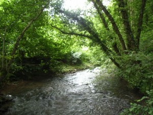 Leigh Brook, Knapp and Papermill Nature Reserve Geological overview
The Leigh Brook flows through the centre of a steep sided gorge in the Knapp and Papermill Nature Reserve. From its source to the south the brook follows relatively low ground, but here it suddenly enters the high ground formed by the hard Silurian rocks before emerging onto the Severn Plain. The valley through the hills is narrow and meanders on a scale fitting a much larger river.
It is believed that before the Ice Age, and before the soft rocks in the surrounding countryside were so greatly eroded away, a large river flowed along this course but on a wide plain at an altitude close to that of the present hill peaks. Some evidence for this rests in the small patches of river gravels found high on the adjacent hills.
During the Anglian Ice Age (500,000 years ago) this area was at the edge of a large ice sheet. As this ice melted, large quantities of melt water gushed down the river and cut a valley through the Silurian rocks to create the gorgewe see today.
Location
Alfrick, Worcestershire; Grid Reference: SO 7491 5170
Access
Open along public rights of way
Geological Age
Quaternary
Features
Fluvial processes
Classic riffle and pool morphology
Gravel bars and mid-channel islands
The brook is one of a rare number of watercourses that cross the Malvern Hills watershed
Geomorphology
Nature Reserve (Worcestershire Wildlife Trust)
Interpretation
Section 9 of the Geopark Way trail
Alfrick and the Suckley Hills’ geology and landscape trail
 Lavingtons Cave, Bridgnorth Geological overview
These rocks represent fossilised sand dunes and were part of a vast desert that existed around 299 million years ago.
During Permian times the Geopark sat landlocked 20 degrees north of the equator on a single continent known as Pangea. This had formed from a drifting together of all the previous continental plates of the earth’s crust. The wind was blowing sand dunes across a vast Sahara-like desert whilst occasional flash floods deposited alluvial fans.
Close inspection of a typical Bridgnorth Sandstone shows the grains of sand within are well rounded and polished by abrasion as they bounced against each other across the desert surface. The sand is dyed red by iron oxide which weakly cements the grains of quartz together.
Bridgnorth town was under siege in 1646, during the Civil War and a Colonel Lavington had forces dig tunnels towards the church, where St. Mary’s stands and where Royalist explosives were stored. He intended to blow up the church, but the event never took place, after excavating a tunnel 70 feet long, the castle surrendered and the digging stopped. The caves have been used as habitations since they were formed.
Location
Bridgnorth, Shropshire; Grid Reference: SO 7176 9282
Access
Open
Geological Age
Permian – Bridgnorth Sandstone Formation
Rock Types
Sedimentary – sandstone
Features
Sedimentary structures
Social history
Interpretation
Section 1 of the Geopark Way trail
Bridgnorth – Rocks beneath your feet (a ‘Walks For Health’ Leaflet)
 Leapgate Old Railway Line, Wilden Top Geological overview
The ‘Old Railway Line’ cuts through the red sandstone bedrock. These sandstones are Triassic in age, belonging to the ‘Sherwood Sandstone Group’ of rocks.
The Sherwood Sandstone Group, the older Permian-aged Bridgnorth Sandstone and the younger Triassic-aged Mercia Mudstone Group have one thing in common; they were deposited in a vast rift basin, called the Worcester Basin.
The Worcester Basin was north-south orientated and formed during the Permian period. Its western edge, in the Geopark area, followed the line of a major fault-line, the East Malvern Fault. In the present day this fault line is most clearly marked by the Malvern, Suckley and Abberley Hills. The eastern edge of the Basin followed the line of another major fault-line, the Inkberrow Fault.
Into this basin a great variety of different sedimentary rocks were deposited and formed. Some were windblown deposits, others were despotised by streams and rivers, evaporate deposits also formed in lakes and the other significant deposit was alluvial fans that formed along the edge of the basin. Each of the rocks represents the changing environments experienced in the basin through the passage of time.
The rocks seen along the ‘Old Railway Line’ belong to the Wildmoor Sandstone Formation, part of the Sherwood Sandstone Group of rocks. They are around 220 million years ago and comprises soft, weakly cemented, pale red-brown, micaceous, sandstones. The well-rounded, evenly sized grains suggest reworking of windblown sands that were deposited the Worcester Basin during the Permian period.
Location
Stourport-on-Severn, Worcestershire; Grid Reference: SO 8269 7202
Access
Open
Geological Age
Triassic – Wildmoor Sandstone Formation
Rock Types
Sedimentary – sandstone, siltstone
Features
Sedimentary structures
Interpretation
Section 5 of the Geopark Way trail
 Loxter Ashbed Quarry Champions Site Geological overview
Loxter Ashbed is a disused limestone quarry. The geology of Loxter Ashbed Quarry dates to the Silurian period of time, approximately 422 million years ago. The rocks are limestones and belong to the Aymestry Limestone Formation. The site is a wonderful example of an anticline together with offering a few fossils.
Loxter Ashbed Quarry is a Community Conservation Champions site. The ‘Champions’ are a loosely knit group of volunteers who are actively involved in the maintenance and public promotion of 19 geological sites spread across the counties of Herefordshire and Worcestershire. They are engaged in a wide range of activities which vary according to the nature of the site.
Location
Wellington Heath, Herefordshire
Access
The site is on private land. Access available to groups by prior arrangement. Please email or phone Mandy on 01531 634303 to arrange a visit.
Geological Age
Silurian – Aymestry Limestone Formation
Rock Types
Sedimentary – Limestone, shale
Features
Anticlinal folding
Area structural geology setting
Fossils
Interpretation
2 x Interpretation boards
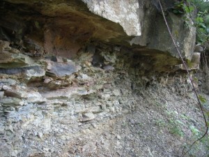
 Carboniferous strata Geological overview
The geology at Martley Rock is exceptionally varied, puzzling and of great scientific interest. Spanning over 700 million years it includes some of the oldest rocks in England. Walking from the entrance to the far side of the site you pass through five geological time periods. Amazing, in such a short distance!
The main feature at the site is an exposure of the most northerly outcrop of the Precambrian aged Malverns Complex (around 700 MY old), some 15 kilometres north of the main Malvern Hills ridgeline. The ancient Precambrian Malverns Complex and the Martley Quartzite (around 530 to 488 MY old) at the site are surrounded by progressively younger rocks. Silurian mudstones (around 416 MY old), Carboniferous mudstones, siltstones and sandstones (around 308 MY old) and Triassic sandstones (around 230 MY old) are all present. Quaternary aged sands, deposited sometime over the last million years, are also visible.
Location
Martley, Worcestershire; Grid Reference: SO 745595
 Shear zone Access
Open, but on private land; Group visits by appointment only
Geological Age
Precambrian – Malverns Complex
Cambrian – Martley Quartzite Formation
Silurian – Raglan Mudstone Formation
Carbonifeorus – Halesowen Formation
Triassic – Bromsgrove Sandstone Formation
Rock Types
Sedimentary – sandstone, siltstone, mudstone, clay, quartzite
Metamorphic – meta-igneous
Igneous – granite, diorite, syenite
Features
Structural geology
Shear zones
Local and regional geological history
Interpretation
Three interpretation boards on-site with QR codes
Site leaflet (click here)
Features on local geology walks – Martley Geology Trail 2 & Martley Geology Trail 3
 Mathon Geological overview
A substantial river once flowed south on the western side of the Malvern Hills ridgeline. This river, the Mathon River, is long gone but the wide river valley that it created, The Colwall Valley, is a landscape feature of today. The sand and gravel deposited from the Mathon River together with younger river, lake and glacier deposits found in the area represent the fluctuations between glacial and interglacial conditions over the last 450,000 years.
The coarse and sandy gravels deposited from the Mathon River contain a high percentage of material from the local area: Silurian limestones and Malverns Complex rocks, together with clasts from further afield, including Bunter Pebbles, coal debris, Longmyndian volcaniclastic sandstones (from the church Stretton area) and Jurassic fossils.
It was around 450,000 years ago that the Anglian Ice sheet, advancing from Wales and terminating near the Malvern Hills, blocked the Mathon River and formed a glacial lake in the Colwall Valley. Deposits of clays and silts observed in Mathon record this event. When the ice finally melted, it left a changed river system. With the Mathon River no longer draining the area, the Cradley Brook developed flowing northwards towards the Leigh Brook, Alfrick, and onto join the River Teme.
Location
Mathon, Herefordshire; Grid Reference: SO 7405 4650 (view point)
Access
Open along public rights of way
Geological Age
Quaternary
Features
Quaternary landform
Geomorphology
Interpretation
Mathon and the Malvern Hills geology and landscape trail
 View from May Hill to the horseshoe bend of the River Severn – the southern most extent of the Geopark Geological overview
May Hill is the most conspicuous landscape feature in the southern part of the Abberley and Malvern Hills Geopark and the views from the top are spectacular in all directions. The striking differences in landscape produced by the diverse underlying geology can be clearly seen in the contrast between the hilly uplands, produced by the older Palaeozoic rocks to the west, and the flat plain of the Severn Vale to the east, formed by softer Mesozoic sediments. Even on the hill itself there are minor variations in relief caused by the diversity of Silurian rocks outcropping. These range from hard limestones to soft sandstones and siltstones and contain a varied assemblage of characteristic Silurian fossils.
The underlying structure of the area is that of a NE trending pericline, truncated by faulting in the north and south, and bounded by more faults to the west and east; the eastern fault being an extension of the major East Malvern Fault that separates the Palaeozoic rocks from the Mesozoic sediments of the Vale. Within these faults, the rocks are folded into a dome, which has been eroded, leaving the oldest rocks exposed in the centre of the dome – the May Hill inlier.
Location
May Hill, Gloucestershire; Grid Reference: SO 6955 2133
Access
Open along public rights of way
Geological Age
Silurian – May Hill Sandstone Group
Features
From the top of the inlier of May Hill views stretch in all directions towards landscapes underlain by rocks of various ages
Interpretation
Section 15 of the Geopark Way trail
May Hill ‘uncovered’ – geology and landscape trail
Geological overview
. . .
Location
Colwall, Herefordshire; Grid Reference: SO 7642 4441
Access
Open
Geological Age
Silurian – Much Wenlock Limestone Formation
Silurian – Coalbrookdale Formation
Rock Types
Sedimentary – limestone, sandstone, siltstone, mudstone
Features
Sedimentary structures
Fossils
Variable lithologies
Stratigraphic sequencing
Area structural geology
Industrial aarchaeology – limekilns
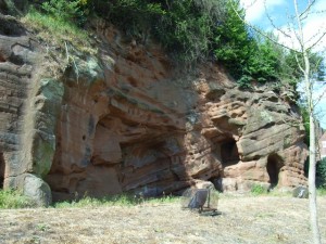
 Redstone Rock Geological overview
Just south of Stourport a magnificent river cliff of fine grained red sandstone is seen. Although mainly homogenous in terms of geology, there are white streaks and thin bands of coarse material running throughout the section.
The soft sandstone of Redstone Rock is easily carved and there is evidence of human-made habitation in the cliff face since Stone Age times. The caves that can be seen today were mostly made in the 12th century, when a hermitage was established there, conveniently located for the hermits to be on hand to offer blessings and prayers for passers-by in return for alms. It was said to house up to 500 men, who may have also manned the ferry crossing, which was there due to the presence of a ford until the river was dredged. The caves were later used as domestic dwellings and were inhabited almost continuously until the mid twentieth century.
Location
Stourport-on-Severn, Worcestershire; Grid Reference: SO 8143 6998
Access
Open along a public right of way
Geological Age
Triassic – Wildmoor Sandstone Formation
Rock Types
Sedimentary – sandstone, siltstone
Features
Sedimentary structures
Social history
Interpretation
Section 5 of the Geopark Way trail
 Variety of lithologies in Carboniferous Etruria Formation Geological overview
This exposure of Carboniferous-aged, Etruria Formation rocks consist of multi-coloured red, purple, yellow and green-grey, commonly mottled mudstone. These sediments were deposited on a well-drained alluvial plain and were extensively affected by soil-forming processes. Layers of sandstone within the layers of finner-grained mudstones and siltstones represent the deposits of shallow river channels and sheet flooding.
Location
Kinlet, Wyre Forest, Shropshire; Grid Reference: SO 7462 7644
Access
Open along a public right of way
Geological Age
Carboniferous – Etruria Formation
Rock Types
Sedimentary – sandstone, siltstone, mudstone, clay
Features
Sedimentary structures
Interpretation
Section 4 of the Geopark Way trail
 Southstone Rock Geological overview
The Teme valley is notable, especially in the Shelsleys area, for the locally abundant deposits of tufa. These calcium rich deposits formed, and in some cases are still forming, as spring waters are discharged through the underlying Bishops Frome Limestone.
Southstone Rock is one of the largest mounds of tufa in the locality and probably formed in part some six to seven thousand years ago. It is of interest both geologically and archaeologically. A small cottage was once situated on top of Southstone Rock. It was also thought to be the site of a chapel and a hermitage, although any traces of these are long gone.
Tufa from the area has been quarried as a building stone. A prime example is the church of St Andrew in Shelsley Walsh.
Location
Stanford with Orleton, Worcestershire; Grid Reference: SO 7085 6395
Access
Open along a public right of way
Geological Age
Quaternary
Rock Types
Tufa
Features
Tufa cliff
Active tufa formation
Spring line
Social history
Interpretation
Southstone Rock geology trail
Geological overview
These exposures of red-brown sandstones with intermittent thin layers of red-brown mudstones are Carboniferous in age and belong to the rock unit known as the Salop Formation, the youngest Carboniferous-aged rock unit in the Geopark. The slightly older Carboniferous-aged sandstones of the Halesowen Formation can be seen not far from here on the higher ground at and around Severn Valley Railways Engine House. The marked difference between these two rock units is the colour, a change from green to red-brown. This change in colour indicates that the environment in which the rocks formed was markedly different.
Rocks of the Halesowen Formation formed in a humid delta environment, whereas the Salop Formation rocks represent sedimentation from rivers on a well-drained alluvial plain.
Location
Severn Valley Country Park, Highley, Shropshire; Grid Reference: SO 7485 8386
Access
Open along public right of way
Geological Age
Carboniferous – Salop Formation
Rock Types
Sedimentary – sandstone
Features
Sedimentary structures
Interpretation
Section 2 of the Geopark Way trail
 Tank Quarry Geological overview
Tank Quarry is one of largest quarries that can be found on the Malvern Hills. Located on the north-eastern side of North Hill, the quarry faces reach approximately 100m in height and are 80m wide at the base.
The geology of Tank Quarry dates to the Precambrian, approximately 680 million years ago, which means that these rocks are some of the oldest exposed in England. The clear quarry face enables amateurs and experts to study the complex nature of the igneous and metamorphic geology on display.
The quarry itself is not accessible however the rest of this large site has many accessible rock faces, a geology trail, interpretation boards, picnic area, wonderful view across the Worcester plain and a carpark.
Tank Quarry is a Community Conservation Champions site. The ‘Champions’ are a loosely knit group of volunteers who are actively involved in the maintenance and public promotion of 19 geological sites spread across the counties of Herefordshire and Worcestershire. They are engaged in a wide range of activities which vary according to the nature of the site.
Location
Malvern, Worcestershire; Grid Reference: SO 7689 4707
Access
There is no access to the main quarry faces. The rest of the site however has open access
Geological Age
Precambrian – Malverns Complex
Rock Types
Igneous – granite, diorite
Features
Pegmatite
Quartz vein
Barytes
Area structural geology setting
Intrusion
Shear zone
Local and regional geological history
Interpretation
Interpretation board
On-site geology cairns with rock specimens
Malvern Community Champions trail and guide
‘Explore’ Malvern Hills 1 guide
Section 10 of the Geopark Way trail
Tank Quarry trail leaflet
 River Teme, Martley Geological Overview
The River Teme is remarkable for its near natural form and as such is a Site of Special Scientific Interest (SSSI) throughout its length. Known as the ‘Wild Daughter of the River Severn’ due to its sinuous nature, it twists its way for 81 miles from its source on Cilfaesty Hill, Powys, Wales, through its often steep-sided valley to its confluence with the River Severn near Worcester.
The history of the River Teme is complicated and encompasses glacial diversions, river captures, glacial lakes, melt-water torrents and bygone river systems.
Today the Lower Teme has a deep channel cut in a wide alluvial plain. Channel plan-form is one dominated by free menders across the floodplain. Since the Teme is a ‘flashy’ river, which responds rapidly to rain fall inputs to the basin, large and rapid changes in stage, velocity and discharge occur. Thus form-process relationships at the channel margins are readily observable and often spectacular in nature. Channel change can be rapid. Cut-offs and near cut-off are numerous along the river’s course and floodplain features such as backchannels and old oxbows can be seen clearly.
Location
Teme Valley, Martley, Worcestershire; Grid Reference: SO 7450 6030
Access
Open along public right of way
Geological Age
Quaternary
Features
Geomorphology
Ice Age interpretation of the changing course of the River Teme
Interpretation
Interpretation board on site
Martley geology trails 1 and 3
Section 7 of the Geopark Way
 The Canyon, near Penny Hill Quarry Geological Overview
The rocks exposed in the Canyon formed during the Silurian period (416-444 million years ago). Back then, the layout of the oceans and continents across the Earth looked very different. The land which would eventually form this part of Britain was located in the southern tropics on a continental shelf, blanketed in a warm, shallow, tropical sea. Carbonate productivity was extremely high in the warm Silurian sea, resulting in sequences of limestones and small patch reefs (bioherms). Pulverised shell debris and crinoid fragments within the limestone layers suggest the Silurian shoreline was prone to occasional heavy storms and vigorous wave action. By the Silurian a great number of sea creatures had evolved hard external skeletons – trilobites, corals, crinoids, brachiopods and mollusca. At times the floor of the tropical sea was, in areas, a waving meadow of generation upon generation of crinoids.
The layers of limestone in the Canyon face are all tilted from the horizontal. This is as a result of a long-lived deformational episode of mountain formation after the rocks were formed – an episode referred to as the Variscan Orogeny. The stresses and strains placed on the once horizontal layers of rock during this episode caused them to uplift, fold and in places be ripped apart along fault lines. Some of the phases of this episode were regional others very localised. By looking at the structures within the rock face it is possible to work the relative ages of the large scale and the very localised deformation phases that this unit of rock has been subjected to.
Location
Martley, Worcestershire; Grid Reference: SO 7526 6176
Access
Open
Geological Age
Silurian – Much Wenlock Limestone Formation
Rock Types
Sedimentary – limestone; shale; bentonite
Features
Fossils
Volcanic ash (bentonite) layers
Faults
Folds
Area structural geology setting
Interpretation
Interpretation board on site
Martley geology trails 1 and 3
Section 7 of the Geopark Way
 The Holding Pens Geological overview
The Holding Pens is a small quarry located adjacent to the Severn Valley Railway viaduct. Slightly set back from the road, it is approximately 10m in depth, 10m high and 6m wide.
The geology of The Holding Pens dates to the Permian period, approximately 295 million years ago. The exposure and the building stone of the viaduct that forms the southern margin of the site, are comprised solely of the Bridgnorth Sandstone Formation, a series of sandstones deposited in a desert environment.
The Holding Pens is a Community Conservation Champions site. The ‘Champions’ are a loosely knit group of volunteers who are actively involved in the maintenance and public promotion of 19 geological sites spread across the counties of Herefordshire and Worcestershire. They are engaged in a wide range of activities which vary according to the nature of the site.
Location
Bewdley, Worcestershire Grid Reference: SO 7905 7545
Access
Permission required to access the quarry. Please contact the Community Conservation Champions. The quarry can however be viewed from the roadside.
Geological Age
Permian – Bridgnorth Sandstone
Rock Types
Sedimentary – Sandstone
Features
Sedimentary structures
Interpretation
Interpretation board on site
‘Bewdley Champions’ booklet available from Bewdley Tourist Information Centre
Informal guided visits to the sites can be arranged. Please contact the Community Conservation Champions.
 Abundant sedimentary and industrial heritage features Geological Overview
The Nubbins escarpment is composed of sediments of Triassic age, the Bromsgrove Sandstone. The rocks display fine sedimentary structures and exhibit many features that delve into the sites industrial history.
Location
Martley, Worcestershire; Grid Reference: SO 748598
Access
Open, but on private land
Geological Age
Triassic – Bromsgrove Sandstone Formation
Rock Types
Sedimentary – sandstone, siltstone, mudstone
Features
Sedimentary structures
Industrial archaeology
Interpretation
Interpretation boards on-site with QR codes
Features on local geology walks – Martley Geology Trail 1, Martley Geology Trail 2 & Martley Geology Trail 3
 The Nubbins Quarry escarpement composed of Triassic aged Bromsgrove sandstone
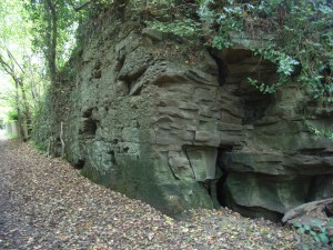 Tramway cutting, Carboniferous sandstone, in Severn Valley Country Park Geological overview
Highley forms part of the Wyre Forest Coalfield, an area covering 50 square kms. Since medieval times the various rock types making up the coalfield have been mined and extracted contributing both to the economy and character of the area.
Stone quarrying has quite literally helped shaped Highley. This tramway was cut to transport coal from the mine at the top of the hill down to the loading bay at the level of the railway line.
These outcrops of rock are made of sandstone and were formed during the Carboniferous period, some 310 million years ago. Back during the Carboniferous rivers flowing from the north transported sand particles into a delta system in the Wyre Forest Coalfield area. As the river entered into this larger mass of water its energy decreased forcing it to deposit the sand particles it was carrying. Over time great quantities of sand accumulated. This sand was then buried and over time the loose material turned into hard rock.
If you take a close look at the rock face you can see defined lines running horizontally across it, breaking the sandstone into layers, called beds. These lines are called bedding planes. The upper bedding plane of each bed represents a pause in deposition of sand into the delta. Within some of the beds you will be able to make out fainter lines, called laminations. The nature of these laminations can be indicative of minor fluctuations in the supply and nature of sediment to the delta.
At the far end of this cutting you can see evidence of where the quarrymen have been at work, preparing the stone. The rock face is covered in pick marks, creating an even surface, known as a dressed surface.
Location
Severn Valley Country Park, Highley, Shropshire; Grid Reference: SO 7485 8284
Access
Open along public right of way
Geological Age
Carbonifeorus – Halesowen Formation
Rock Types
Sedimentary – sandstone
Features
Sedimentary structure
Industrial archaeology
Interpretation
Section 2 of the Geopark Way trail
Severn Valley trail: Bridgnorth to Highley
Highley Trail
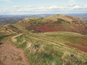
 View across the Teme Valley to the Bromyard Plateau and the Clee Hills (north), from Pudford Hill ridgeline Geological Overview
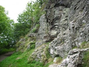
The ridgeline rises out of the otherwise gently rolling landscape, is made up of rocks that are around 420 million years old, formed during the Silurian period. Precambrian rocks, such as those in the Malvern Hills are overlain by folded and faulted shale and limestone. These rocks were uplifted, along a line of weakness in the Earth’s crust, during a mountain building event between 360 and 250 million years ago. Since they were uplifted, the limestones have withstood the ravages of erosion over time to eventually remain standing proud of the surrounding landscape because they are much harder.
The individual hills are offset from each other, rather than one continuos ridge due to the cluster of faultlines in the area. Movemnet along these faults have displaced the hard limestone.
The high vantage point afforded to the ridgeline gives rise to spectacular views across the surrounding landscapes. The ridgeline divides the Palaeozoic rocks to the west from the Mesozoic rocks to the east. This divide gives rise to variable landscapes due to the dfferent underlying rock types present either side of the divide and due to the significant difference between the number of earth movements each has experienced over their geological history.
Location
Shelsleys & Martley, Worcestershire; Grid Reference: SO 7429 6604 (north) – SO 7468 6091 (south)
Access
Open along public right of way
Geological Age
Silurian
Features
Views of landscapes and landforms
Teme Valley, Bromyard Plateau, Clee Hills, Worcester Basin, Malvern Hill
Ridge and vale topography
Geomorphology
Geological history setting
Structural geology
Interpretation
Interpretation boards on the ridge
Martley Geology Trail 1
Martley Geology Trail 3
Section 7 of the Geopark Way trail
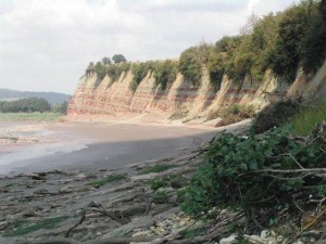 Triassic Mercia Mudstone and Penarth Group at the Garden Estuary, Westbury Geological overview
The succession of rock units present in the river cliff are Late Triassic in age spanning both the Mercia Mudstone Group and the Penarth Group.
The red rocks that make up most of the lower part of the cliff are known as the Twyning Mudstone Formation; the overlying buff and green-grey layers belong to Blue Anchor Formation, both members of the Mercia Mudstone Group unit of rocks.
Above the Mercia Mudstone Group are the Westbury Formation and Lilstock Formation rocks, both belong to the Penarth Group unit of rocks. The former consists of dark grey to black, fossiliferous mudstones and thin sandstones with a ‘bone bed’ near the base of it containing many microfossils, bivalves, gastropods, fish and bones. The Lilstock Formation is a pale grey calcareous mudstone with a few thin siltstones and nodular, fine-grained limestones.
Collectively the rock units capture the transition of the depositional environment from a terrestrial to marine setting. The older units (Mercia Mudstone Group) are a mixture of aeolian dust, lake and sheetflood sediments deposited in an arid or semi-arid environment (evaporite minerals gypsum and halite confirm this environment). The Blue Anchor Formation is a mixture of freshwater lake and marine deposits. The overlying Penarth Group marks a change from the terrestrial environments into shallow marine shelf environments as a global sea level rise caused the low-lying area of the Worcester Basin to be inundated by the sea.
Location
Westbury on Severn, Gloucestershire; Grid Reference SO 718 128
Access
Open NOTE TIDAL so select appropriate times and dates to visit
Geological Age
Triassic – Mercia Mudstone Group; Penarth Group
Rock Types
Sedimentary – Mudstone; siltstone
Features
Variable lithologies
Fossils
Stratigraphic sequencing
|
The Geopark Way long distance walking trail
Contact Details Abberley and Malvern Hills Geopark Forum:
c/o Outreach Team
Email: amhg@outlook.com
|